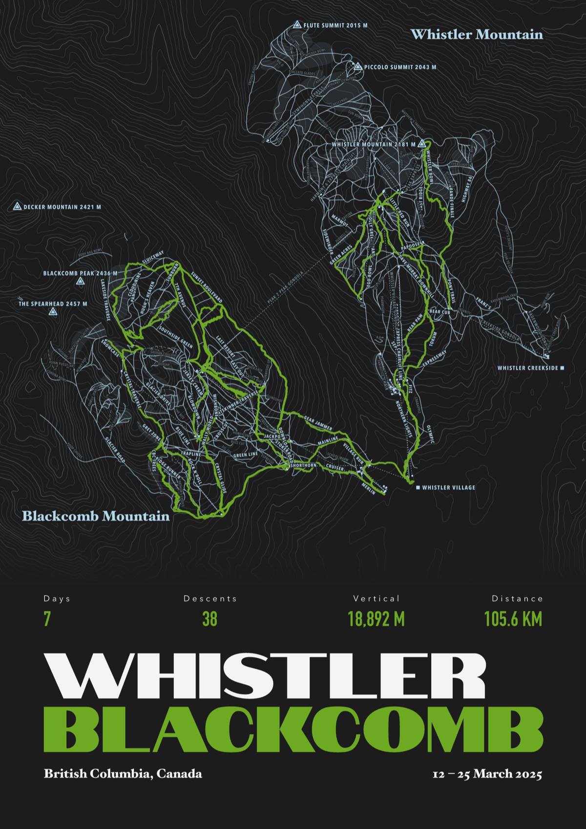
Personalised map poster of your route
A ski week, a sportive, a marathon, a long walk or a sea swim, drawn from your own GPS and printed to order.
- Sizes
- A3 (297 × 420 mm) or A2 (420 × 594 mm)
- Paper
- Museum-grade matte, 250 gsm, archival and acid free
- Frame
- None, or natural wood (pine), dark wood, black or white, all one price. Acrylic glazing, no mount, ready to hang
- Colourways
- Our own set, each with a colour kept just for your line, or pick your own three
- Words
- Two-line title, a line above it and a line at the foot. You see them as you type
- Price
- £45 A3 · £59 A2 unframed, launch price until 31 December, then £55 and £69 from 1 January · £99 A3 framed · £129 A2 framed
- Timing
- First look in two working days, then five to seven working days in the UK, seven to twelve elsewhere
Nothing prints until you've approved your first look. One round of changes is free.

Map print frames in four colours
Natural pine, dark wood, black or white, all the same price in each size. Acrylic glazing, no mount, ready to hang.
Framed and hung


Frames in natural wood, black or white, A3 or A2.
Questions about the map print
Which apps work?
Anything that exports a GPX, FIT or TCX file: Strava, Garmin, Komoot, Wahoo, Coros, Suunto, Polar, Apple Watch, Slopes, Ski Tracks and the rest. Slopes is best for skiing because it already knows a lift from a run. Carv and My Epic don't allow exports yet.
Where can you draw?
Anywhere that's in OpenStreetMap, which is most of the world. If your place is too thinly mapped to make a print worth hanging, we'll tell you and refund you before anything's made.
What's on the print?
The place, drawn fine and quiet. Your route across it in the brightest colour on the page. Numbers from your file, your title across the foot, and the date if you want it. For a race, a finisher's medal with your time.
One day or a whole season?
Either. One place per print, and as many days there as you like. A single swim, a week on the mountain or a whole long-distance trail all fit.
How accurate is it?
Your line is drawn exactly as your watch or phone recorded it, to within a few metres. We fix the heights against open elevation data, because watches get altitude wrong, and take your climbing from your own app so the numbers match.
Can I change the words?
Yes. Two lines of title, a small line above it and a line at the foot, and you see them on the print as you type. Leave them blank and we use the place and the date.