Aspen Snowmass trail map
Four mountains on one pass: Snowmass, Aspen Mountain, Aspen Highlands and Buttermilk. Every run and lift on one map, the numbers, and your own days drawn on it.
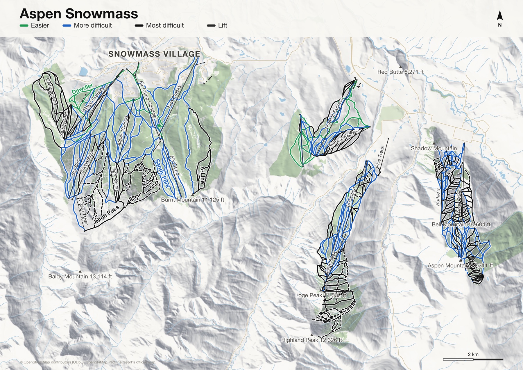
Aspen Snowmass at a glance
- Named runs
- 362
- Lifts
- 38
- Runs mapped
- 262 km
- Top of the mapped runs
- 12,516 ft (3,815 m)
- Bottom of the mapped runs
- 7,881 ft (2,402 m)
- Areas
- 4, each its own map
From open map and elevation data, September 2026.
Runs and lifts at Aspen Snowmass
393 named runs and 35 named lifts, by grade.
Easier (23)
- Assay Hill
- Blue Grouse (Buttermilk)
- Dawdler
- Eagle Hill
- Fanny Hill
- Funnel Bypass
- Galavant
- Homestead Road
- Larkspur
- Lunchline (Lower)
- Lunchline (Upper)
- Magic Carpet
- Nor Way
- Oregon Trail (To Tiehack)
- Panda Hill
- Rabbit Run
- Red's Rover
- Scooper (Lower)
- Scooper (Upper)
- Sterner Catwalk
- Tom's Thumb
- Troyer's Trail
- Westward Ho
More difficult (142)
- 1 & 2 Leaf
- 1 & 2 Leaf Bottom Half
- Adams' Avenue (Lower)
- Adams' Avenue (Upper)
- Apple Strudel
- Baby Doe
- Back of Bell Cutt-off
- Banzai Ridge
- Bear
- Bear Bottom
- Bellissimo
- Big Face Hollow
- Blue Grouse
- Bottoms Up
- Broadway
- Buckhorn
- Buddy System
- Bull Run
- Camp Bird
- Cascade (Lower)
- Cascade (Upper)
- Coffee Pot
- Columbine
- Coney Glade
- Copper
- Copper Bowl
- Copper Connector
- Creekside (Lower)
- Creekside (Upper)
- Cutoff
- Dallas Freeway
- Deane's
- Deer Park
- Dipsy Doodle
- Drumstick
- E. 5th Ave
- East Branch
- Easy Chair
- Eddy Out
- Exibition
- Face of Bell Cut-off
- Friedl's
- Funnel
- Gene Reardon's Run
- Golden Barrel
- Golden Horn
- Grand Pr
- Granite
- Green Cabin (Lower)
- Green Cabin (Upper)
- Gretl's
- Grey Wolf
- Gunbarrel
- Gunner's View
- Hal's Hollow (Lower)
- Hal's Hollow (Upper)
- Hayden
- Heather-Bedlam
- Hodge Podge
- Jack of Hearts
- Jerome
- Kleenex Cornner
- Lazy Boy
- Lazy8 Gully
- Lodgepole
- Log Deck
- Long Shot
- Lover's Lane
- Lower Banzai
- Lower Corkscrew
- Lower Little Nell
- Lower Olympic
- Lower Savio
- Lud's Lane
- Lunkerville
- Magnifico
- Magnifico Road
- Max Park
- Meadows
- Memory Lane
- Mick's Gully
- Midnight
- Midway
- Midway Ave
- Midway Road
- Monkshood
- Moonshine
- Naked Lady
- No Problem
- Normandy
- North American
- Nugget
- Park Avenue
- Pipeline
- Prospector
- Prospector Gulch
- Pyramid Park
- Red Onion
- Rideout
- Ridge Trail
- Riverside Dr.
- Roch Run
- Rocky Mountain High
- Ruthie's Run
- Sandy Park
- Savio
- Scarlett's Run
- Schuss Gully
- Shear Bliss
- Sheer Bliss
- Silver Bell
- Silver Dip
- Slider
- Smuggler
- Sneaky's
- Spar Gulch
- Sterner Gulch
- Strawpile
- Summer Road
- Sunnyside
- T-Lazy Catwalk
- Teaser
- Thunder Bowl
- Thunderbowl
- Timberline
- Tortilla Flats
- Tourtelotte Park
- Tower Ten Road
- Trestle
- Turkey Trot
- Upper Jerome
- Upper Little Nell
- Upper Robinson's
- Upper Roch Run
- Ute Chute
- Velvet Falls (Lower)
- Velvet Falls (Upper)
- West 5th Ave
- West Fork
- Whispering Jesse
- Wine Ridge
- Wineskin
Most difficult (92)
- A-Line
- Alps
- Aztec
- Back of Bell #1
- Back of Bell #2
- Bear Hollow Road, South Fork
- Bearclaw
- Bell Meadow
- Blazing Star
- Blondie's
- Boomerang
- Cabin
- Camp Three
- Campground (Lower)
- Campground (Upper)
- Dispy Headwall
- Face of Bell
- Face of Olly
- Fast Draw
- FIS Slalom Hill
- FIS Trail
- Free Fall
- Garrett Gulch
- Gent's Ridge
- Glissade
- Government
- Hanging Tree
- High Pass
- Howler
- I-70
- International
- Jacob's Ladder
- Javelin
- Jim's
- Kandahar
- Keith Glen
- Keith Glen Glade
- Knowlton's
- Le Chamonix
- Limelight
- Little Teaser
- Lower Larkspur
- Lower Roch Run
- Middle Fork
- Mousetrap
- North Fork
- North Star
- Northstar
- Olymic Bowl Exit
- P-Chutes Road
- Percy
- Powder Bowl
- Promenade
- Ptarmigan Glade
- Pussyfoot
- Racer's Edge
- Reds Run
- Reidar's
- Rio
- Robinson's Run
- Schiller Road
- Seibert's
- Separator
- Sherwood Forest
- Showcase
- Slot (Lower)
- Slot (Upper)
- South Fork
- Split Tree
- Spring Pitch
- Spring Time
- Spruce
- Spruce Face
- Sterner
- Summit
- Sunrise
- Sunrise/Sunset
- Superpipe
- Suzi Q.
- The Edge
- Tiehack Parkway
- Tiehack Trail
- Timber Doodle Glade
- Tom's Trace
- Traynor Ridge
- Uncle Chuck's Glades
- West Face
- Why
- Why Knot
- Wildcat
- Wildcat (Lower)
- Zugspitze
Expert (136)
- 1A Lift Line
- Aces & Eights
- Aeroble
- AMF
- Audacious
- Baby Ruth
- Ballroom
- Bear Hollow Road
- Bear Paw
- Bell Glades
- Bingo Glades
- Bob's Glade
- Bonnie Bell
- Boomerang Woods
- Buckskin
- Buckskin Cliffs
- Cassidy's Union
- Cirque Cornice
- Cirque Dikes
- Cirque Headwall
- Cone 1
- Cone 2
- Cookies
- Corkscrew
- Corkscrew Gully
- Cory-Bob
- D’kine Bowl
- Deception
- E.E.K.!
- East Wall
- Eden
- Elli's
- Epicure
- Fat City
- First Tracks
- Flip's Leap
- Franklin Dump
- G-0
- G-1
- G-2
- Garmisch
- Glade #1
- Glade #2
- Glade #3
- Glade One
- Glade Three
- Glade Two
- Golden Horn Woods
- Gowdy's
- Grand Reverse
- Grand Traverse
- Grinder
- Hanging Valley Exit
- Hanging Valley Glades
- Harris's Wall
- Headwall
- Here's Too...
- Hot Y's (Y-3 to Y-8)
- Hyde Park
- Hyrup's
- Jackpot
- Kessler's
- Kristi
- KT Gully
- Lady Luck
- Last Dollar
- Legel Tender
- Lens Cap
- Little Headwall
- Loushin's
- Lower Golden Horn
- Lower Golden Horn #2
- Lower Kristi
- Lower Ladder
- Lower Stein
- Lower Walsh's
- Lucky Find
- Mike Drop
- Moment of Truth
- Mosh Pit
- Mushroom
- Niagara
- No Name (Highlands)
- Norway
- Ollie's Yot
- P-Chutes #2
- Papa Bear
- Perry's Prowl
- Possible
- Powderhorn
- Powerline I
- Powerline II
- Ptarmigan
- Rayburn's
- Rener's Rock
- Rewrite
- Ridge of Bell
- Roberto's
- Rock Band Chute
- Rock Island
- S1
- Short Snort
- Shoulder of Bell
- Silver Queen
- Silver Queen Ridge
- Silver Rush
- Soddbuster
- South Castle
- St. Moritz
- Star Walk
- Strawberry Patch
- Super 8
- T1
- T2
- T3
- T4
- T5
- T6
- The Shaft
- The Wall
- Traverse
- Upper Ladder
- Upper Stein
- Ute Camp
- Valley Valley
- Wall 1
- Wall 2
- Walsh's
- Waters
- Weird Woods
- West I
- West II
- Whip's Veneration
- Willy's
- Y-12
- Zaugg Dump
Lifts (35)
- Ajax Express Chairlift
- Alpine Springs Chairlift
- Assay Hill Chairlift
- Big Burn Chairlift
- Campground Chairlift
- Cirque T-Bar T-bar
- Cloud Nine Chairlift
- Coney Express Chairlift
- Deep Temerity Chairlift
- Elk Camp Chairlift
- Elk Camp Gondola Gondola
- Exhibition Chairlift
- F.I.S. Chairlift
- Five Trees Chairlift
- Hero's Chairlift
- High Alpine Chairlift
- Loge Peak Chairlift
- Meadows Chairlift
- Panda Peak Chairlift
- Pines Lower Button lift
- Pines Upper Button lift
- Ruthie's Chairlift
- Sam's Knob Chairlift
- Scooper Button lift
- Sheer Bliss Chairlift
- Silver Queen Gondola
- Ski School Lift Drag lift
- Ski School Magic Carpet Magic carpet
- Sky Cab Gondola
- Summit Express Chairlift
- Thunderbowl Chairlift
- Tiehack Express Chairlift
- Two Creeks Chairlift
- Village Express Chairlift
- West Buttermilk Express Chairlift
How Aspen Snowmass fits together
Aspen Snowmass is four separate mountains around the town of Aspen, on one lift pass. Snowmass is the biggest by far, wide and rolling. Aspen Mountain rises straight out of town.
Aspen Highlands is known for Highland Bowl, hiked from the top of the lifts, and Buttermilk is the gentle one, where people learn. Each is its own map; a print shows whichever you skied.
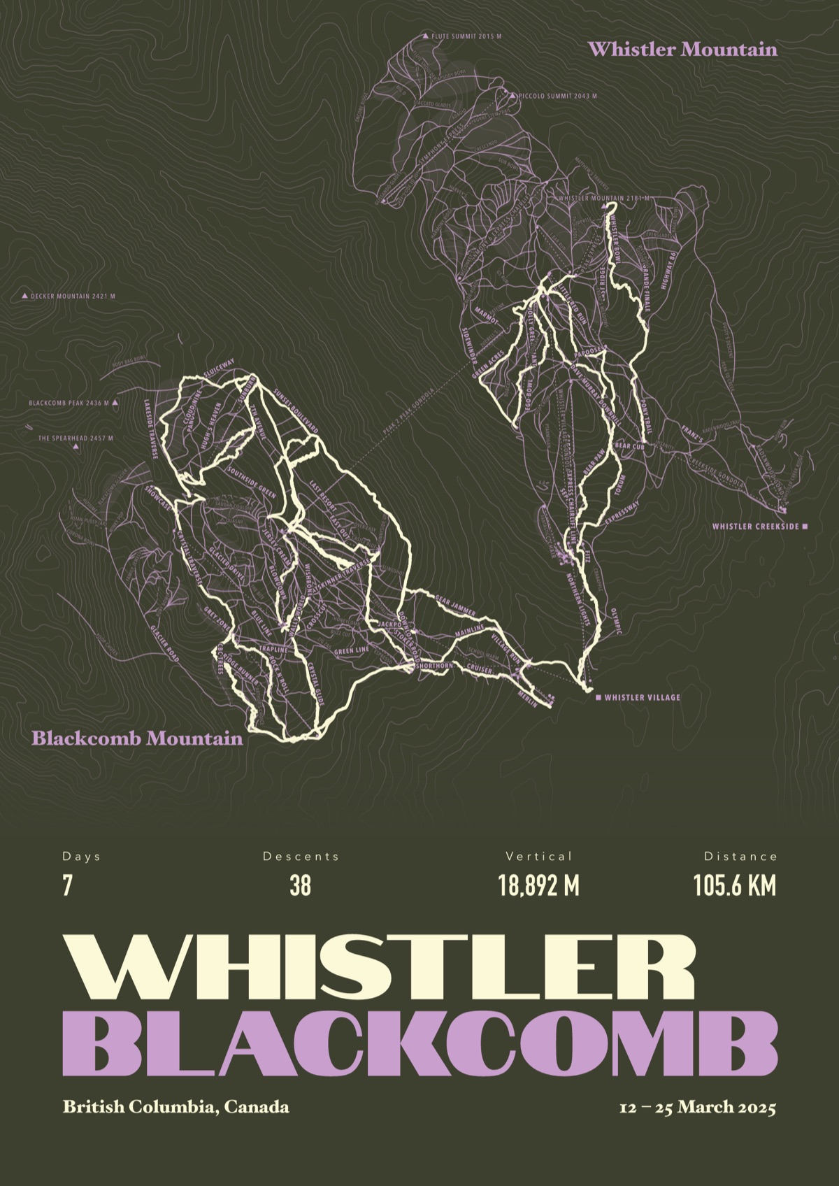
Your Aspen Snowmass, run by run
Every run and lift at Aspen Snowmass, named, with your own line across it from your phone or watch. One day, one trip or the whole season.
The print shown is Whistler Blackcomb. Yours is drawn from your own days at Aspen Snowmass.
£45 unframed Launch price until 31 December
£55 from 1 January · £99 framed
Free delivery to the UK, US, Canada, Australia and New Zealand
For the painted map, see the official Aspen Snowmass trail map on the resort's own site.
Good questions
How many runs does Aspen Snowmass have?
OpenStreetMap has 362 named runs and 38 lifts at Aspen Snowmass. The resort counts its runs its own way, so its number may differ.
How high does Aspen Snowmass go?
The highest mapped run starts at about 12,516 ft (3,815 m), and the lowest ends at about 7,881 ft (2,402 m).
Is this the official trail map?
No. Ours is drawn from OpenStreetMap, the open map anyone can edit. For lift status and grooming, use the resort's own map on the day.
Can I get a print of my own days at Aspen Snowmass?
Yes. Send the file from Slopes, Strava, a Garmin or any app that exports GPX, and we draw your runs on the whole resort, every run named.
Map data © OpenStreetMap contributors. Custom Map Print is not connected to Aspen Snowmass or its operators.
More ski resort maps
- Vail trail mapColorado, USA · 235 named runs · 32 lifts
- Killington trail mapVermont, USA · 162 named runs · 22 lifts
- Mont Tremblant ski mapQuebec, Canada · 115 named runs · 12 lifts
- Lake Louise ski mapAlberta, Canada · 113 named runs · 13 lifts
Colorado ski resorts map · All ski resort maps · Ski prints · Snowboard prints
Your runs, on the whole mountain
Send the file from your phone or watch, pick the colours, and we'll take it from there
Make yours