Lake Louise ski map
Banff National Park, looking across at the lake and the glacier. Every run and lift on one map, the numbers, and your own days drawn on it.
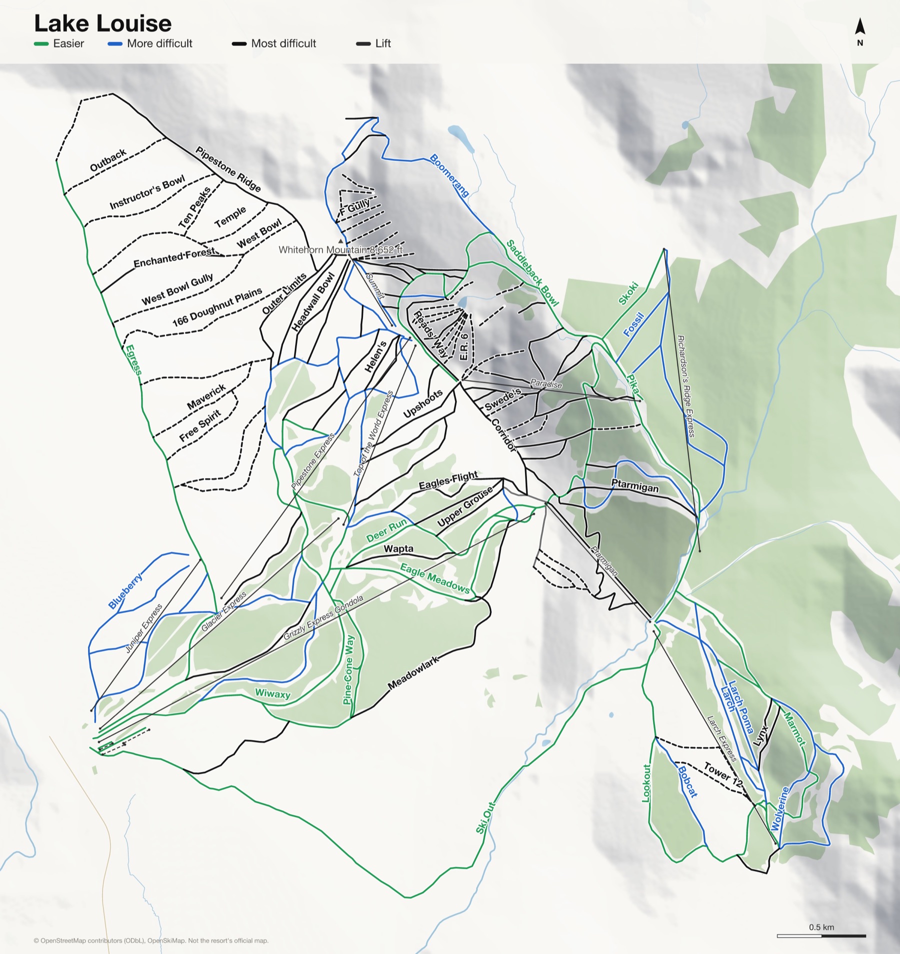
Lake Louise at a glance
- Named runs
- 113
- Lifts
- 13
- Runs mapped
- 80 km
- Top of the mapped runs
- 8,675 ft (2,644 m)
- Bottom of the mapped runs
- 5,404 ft (1,647 m)
- Vertical
- 3,271 ft (997 m)
From open map and elevation data, September 2026.
Runs and lifts at Lake Louise
149 named runs and 10 named lifts, by grade.
Easier (19)
- 30 Goats
- Bald Eagle
- Deer Run
- Eagle Meadows
- Easy Street
- Egress
- Jerry's Jungle
- Lookout
- Marmot
- Marmot to Lookout connector
- Pika
- Pine Cone Way
- Ski Out
- Skoki
- Sunny Side
- Upper Wiwaxy
- Warden's Run
- Whitehorn Cat Track
- Wiwaxy
More difficult (30)
- Bearberry
- Blueberry
- Bobcat
- Boomerang
- Buffaloberry
- Bunchberry
- Cameron's Way
- Charlie's Choice
- Fossil
- Gully
- Home Run
- Juniper
- Juniper Jungle
- Larch
- Larch Poma
- Larch Poma to Larch Connector
- Lower Flight
- Merlin
- Old Ptarmigan
- Race Pitch
- Redoubt
- Rock Garden
- Saddleback Bowl
- Skyline
- Sunset
- Sunset Terrace
- Upper Juniper
- Vermillion
- Wolverine
- Wrong Turn
Most difficult (73)
- "007" Ptarmigan Cat Track
- 4/5 Shoulder
- 166 Doughnut Plains
- Alley
- Corridor
- Couloir
- Crow Bowl
- Eagle Poma
- Eagles Beak
- Eagles Flight
- East Bowl
- Enchanted Forest
- Exhibition
- Flight Chutes 1
- Flight Chutes 2
- Flight Chutes Cat Track
- Forth Gate
- Free Spirit
- Headwall
- Headwall Bowl
- Helen's
- Home Run Chutes
- Hour Glass
- Instructor's Bowl
- Instructor's Gully
- Kiddies' Corner
- Ladies' Downhill
- Lipalian Chutes
- Little Pipestone
- Lower 5
- Lower Meadowlark
- Lynx
- Maitenance Gully
- Maverick
- Meadowlark
- Men's Downhill
- Middle Limits
- Oly Slides East
- Oly Slides West
- Outback
- Outer Limits
- Paradise Bowl
- Pika Trees
- Pipestone Ridge
- Powder Pockets
- Ptarmigan
- Ptarmigan Chute 1
- Ptarmigan Chute 2
- Ptarmigan Chute 3
- Raven
- Reads' Way
- Ridge Run
- Rodney's Ridge
- Second Gate
- Steep & Flat
- Sunset Gully
- Sunset Pocket
- Temple
- Ten Peaks
- The Heart
- Third Gate
- Tickety Chute
- Tight Turn
- Two Thirds Shoulder
- Upper Boomerang
- Upper Grouse
- Upper Meadowlark
- Upshoots
- Wapta
- West Bowl
- West Bowl Gully
- White Rabbit
- Whitehorn 1
Expert (27)
- A Gully
- B Gully
- Big 7
- C Gully
- Cowboy
- D Gully
- Drop Out
- E Gully
- E.R. 3
- E.R. 6
- F Gully
- Fenceline Gully
- G Gully
- H Gully
- I Gully
- Jackpot
- Lookout Chutes
- Paradise Cornice
- Peyto's Pitch
- Split Rock
- Swede's
- The Beast
- Tower 12
- Upper 5
- Upper Kiddies'
- Vertical Cornice
- Wounded Knee
Lifts (10)
- Glacier Express Chairlift
- Grizzly Express Gondola Gondola
- Juniper Express Chairlift
- Larch Express Chairlift
- Paradise Chairlift
- Pipestone Express Chairlift
- Ptarmigan Chairlift
- Richardson's Ridge Express Chairlift
- Summit Chairlift
- Top of the World Express Chairlift
How Lake Louise fits together
Lake Louise sits in Banff National Park. The front side faces across the Bow Valley to Lake Louise itself and the Victoria Glacier, one of the best views from any chairlift anywhere.
Behind it are the back bowls, open and steep, and the Larch area, sheltered and quieter on a cold day.
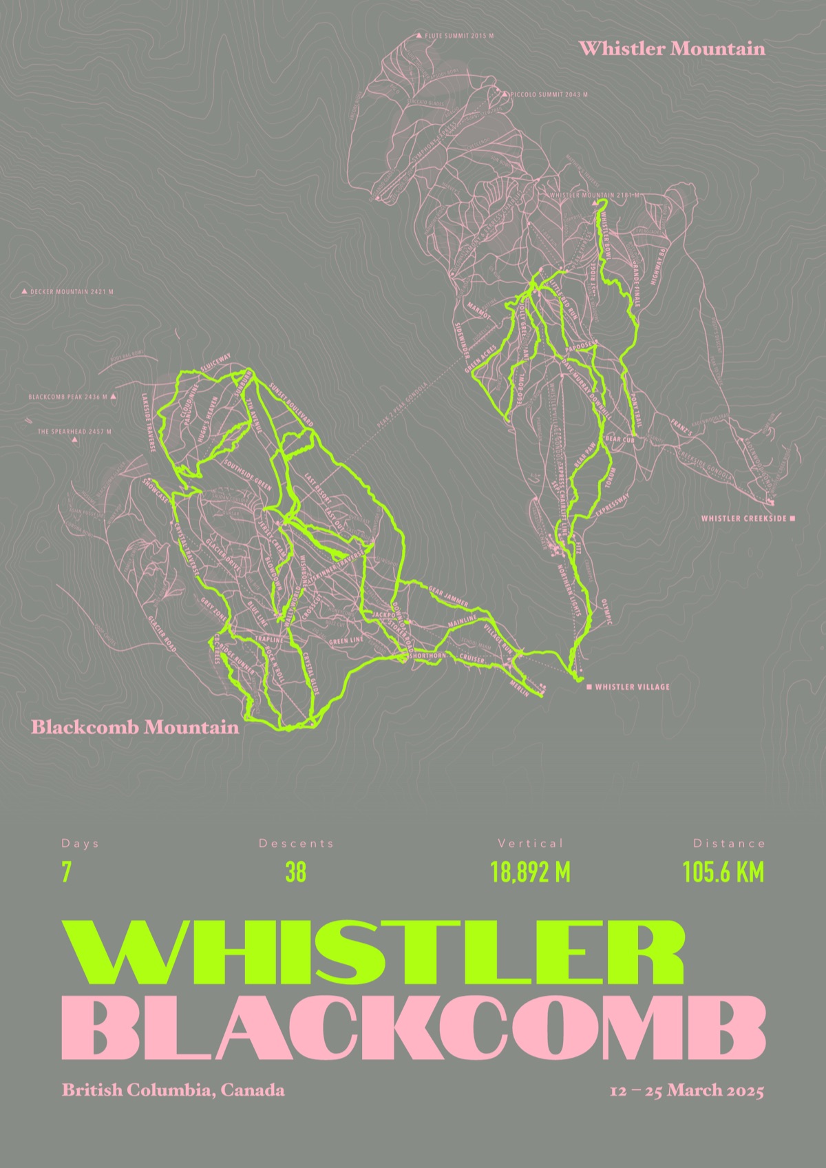
Your Lake Louise, run by run
Every run and lift at Lake Louise, named, with your own line across it from your phone or watch. One day, one trip or the whole season.
The print shown is Whistler Blackcomb. Yours is drawn from your own days at Lake Louise.
£45 unframed Launch price until 31 December
£55 from 1 January · £99 framed
Free delivery to the UK, US, Canada, Australia and New Zealand
For the painted map, see the official Lake Louise trail map on the resort's own site.
Good questions
How many runs does Lake Louise have?
OpenStreetMap has 113 named runs and 13 lifts at Lake Louise. The resort counts its runs its own way, so its number may differ.
How high does Lake Louise go?
The highest mapped run starts at about 8,675 ft (2,644 m), and the lowest ends at about 5,404 ft (1,647 m).
Is this the official trail map?
No. Ours is drawn from OpenStreetMap, the open map anyone can edit. For lift status and grooming, use the resort's own map on the day.
Can I get a print of my own days at Lake Louise?
Yes. Send the file from Slopes, Strava, a Garmin or any app that exports GPX, and we draw your runs on the whole resort, every run named.
Map data © OpenStreetMap contributors. Custom Map Print is not connected to Lake Louise or its operators.
Your runs, on the whole mountain
Send the file from your phone or watch, pick the colours, and we'll take it from there
Make yours