La Clusaz ski map
Five linked massifs above the village. Every run and lift on one map, the numbers, and your own days drawn on it.
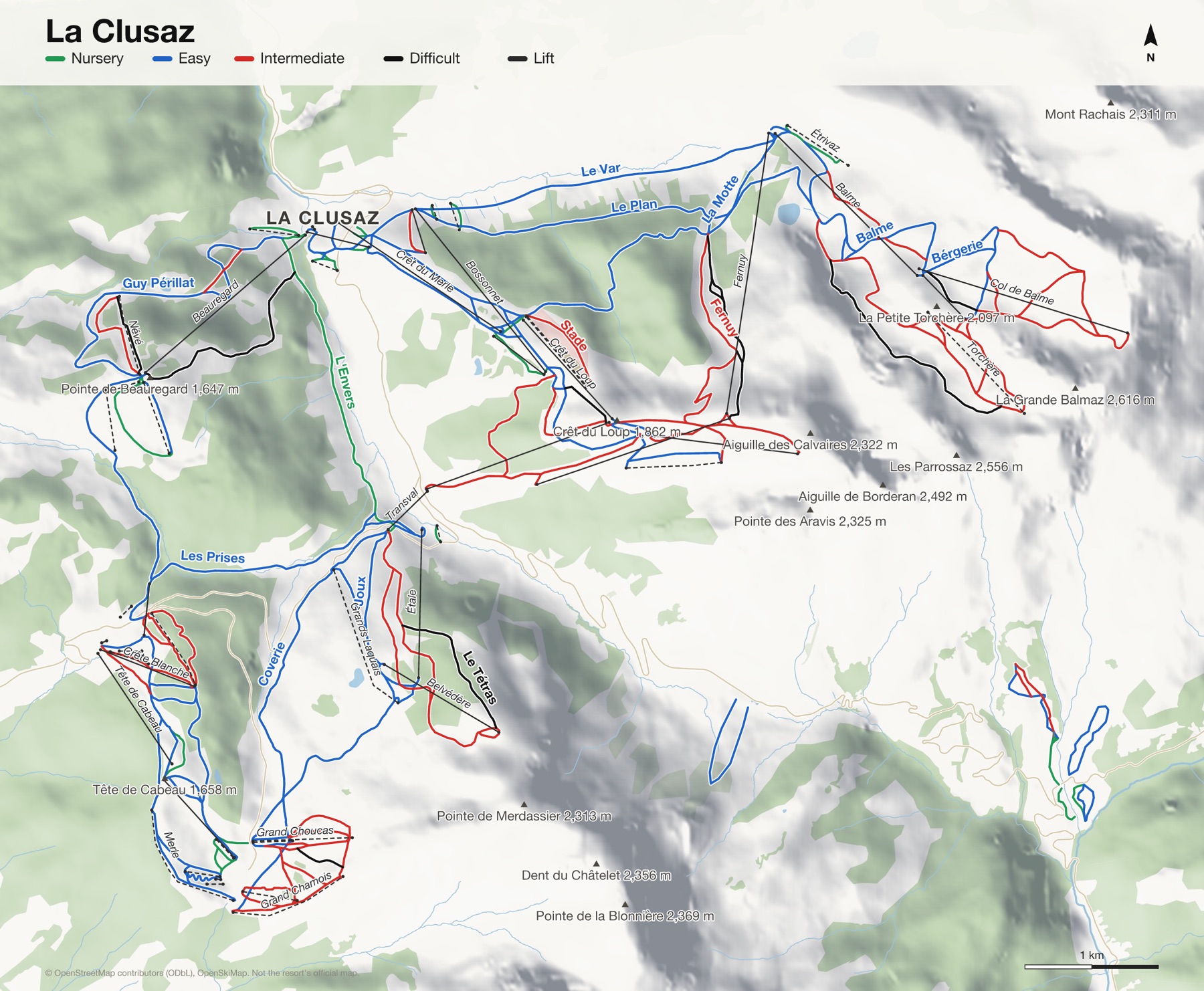
La Clusaz at a glance
- Named runs
- 107, counted by hand
- Lifts
- 51
- Runs mapped
- 96 km
- Top of the mapped runs
- 2,476 m (8,123 ft)
- Bottom of the mapped runs
- 1,030 m (3,379 ft)
- Vertical
- 1,446 m (4,744 ft)
From open map and elevation data, September 2026.
Runs and lifts at La Clusaz
98 named runs and 50 named lifts, by grade.
Nursery (17)
- Abbaye Verte
- Balme, L'Etrivaz
- chevreuil - croix fry
- Genêts
- L'Ecureuil, La Marmotte, Pugis
- L'Envers
- L'Envers, Les Joux
- L'Etrivaz
- Le Champ Bleu
- Le Coeur Du Village
- Le Nant
- Le Plateau
- Les Joux, L'Envers
- Les Pugis
- Mini-Loup
- Portatif
- Pugis
Easy (42)
- Abbaye Droite
- Abbaye Gauche
- Armoise
- Balme
- Balme, Lachat
- Bérgerie
- Boarder Cross
- Bolets
- choucas - chamois
- Col des Aravis Droite
- Col des Aravis Gauche
- Coverie
- Croix Fry - Etale
- Fouine
- Framboise
- Gentiane
- Girolles
- Grande Montagne
- Guy Périllat
- Joux
- Jument 2000
- L'Aiguille
- L'Ecureuil
- L'Ecureuil, La Marmotte
- La Motte
- La Noire, Guy Périllat
- La Ruade
- Le Bossonnet
- Le Dahu
- Le Merle
- Le Plan
- Le Var
- Les Aiglons
- Les Joux
- Les Laquais
- Les Prises
- loup - juments2000
- Maigre Droite
- Maigre Gauche
- Marmottes
- Myosotis
- Polailles
Intermediate (31)
- Ancolie
- Blanchot
- Botion
- Combe des Juments
- Edelweiss
- Eterlou
- Fernuy
- Grand Choucas
- Jeannot
- juments2000 - la piaz
- La Marmotte
- Lachat
- Le Loup
- Les Bois
- Les Crintiaux
- Les Mélèzes
- Marmotte Bis
- Mur du Bossonnet
- Mur Jaune
- myrtilles
- Névé
- Petit Chamois
- Régine Cavagnoud
- Roualle
- Sapins
- Sorbiers
- Stade
- Tête Blanche
- Torchère
- Verâtres
- Vrailles
Difficult (7)
- Joubarbes
- La Noire
- Lapiaz
- Le Tétras
- Les Choucas
- Mur Edgar
- Vraille
Ungraded (1)
- Clapières - Puginières
Lifts (50)
- Aiglons Button lift
- Aiguille Chairlift
- Baby Button lift
- Baby Chou Button lift
- Balme Gondola
- Beauregard Gondola
- Belvédère Chairlift
- Bergerie Chairlift
- Blanchot J-bar
- Bossonnet Chairlift and gondola
- Ceutire Drag lift
- Champ Bleu Button lift
- Champs Giguet Magic carpet
- Chevrette Button lift
- Chevreuil Chairlift
- Club des Oursons Magic carpet
- Col de Balme Chairlift
- Combe des Juments Chairlift
- Côte 2000 Chairlift
- Crêt du Loup Chairlift
- Crêt du Merle Chairlift
- Crête Blanche Chairlift
- Croix Fry Chairlift
- Étale Chairlift and gondola
- Étoile des Neiges Button lift
- Étrivaz Button lift
- Fernuy Gondola
- Grand Chamois Button lift
- Grand Choucas Button lift
- Grand Crêt Button lift
- Grands Laquais Button lift
- Grenêche Chairlift
- Juments 2000 Button lift
- Louveteau Button lift
- Merle Button lift
- Nant Button lift
- Névé Button lift
- P'tit Bossonnet Drag lift
- P'tit Loup Chairlift
- Patinoire Gondola
- Petit Chamois Button lift
- Petit Choucas Button lift
- Rhodos Button lift
- Riffroids Button lift
- Rosières Button lift
- Stade Button lift
- Tête de Cabeau Chairlift
- Torchère Button lift
- Transval Cable car
- U'Fredy Button lift
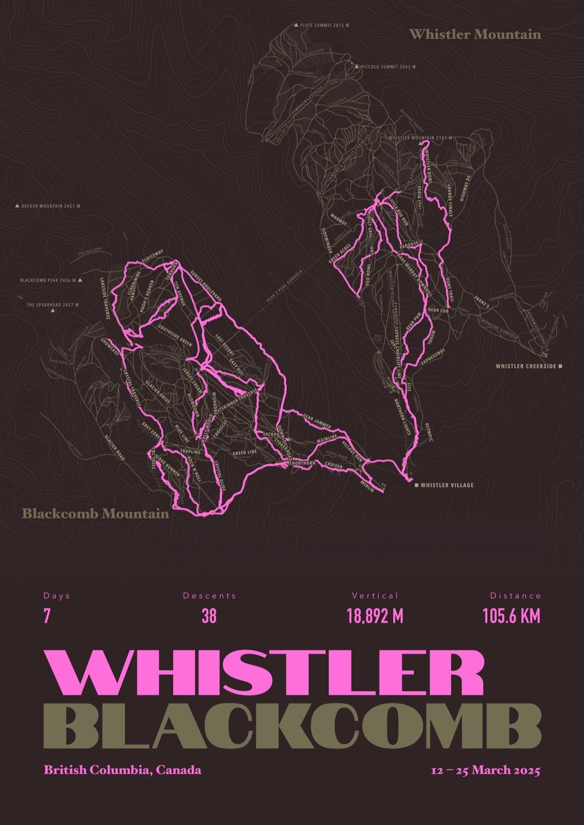
Your La Clusaz, run by run
Every run and lift at La Clusaz, named, with your own line across it from your phone or watch. One day, one trip or the whole season.
The print shown is Whistler Blackcomb. Yours is drawn from your own days at La Clusaz.
£45 unframed Launch price until 31 December
£55 from 1 January · £99 framed
Free delivery to the UK, US, Canada, Australia and New Zealand
For the painted map, see the official La Clusaz piste map on the resort's own site.
Good questions
How many runs does La Clusaz have?
OpenStreetMap has 107 named runs and 51 lifts at La Clusaz. The resort counts its runs its own way, so its number may differ.
How high does La Clusaz go?
The highest mapped run starts at about 2,476 m (8,123 ft), and the lowest ends at about 1,030 m (3,379 ft).
Is this the official trail map?
No. Ours is drawn from OpenStreetMap, the open map anyone can edit. For lift status and grooming, use the resort's own map on the day.
Can I get a print of my own days at La Clusaz?
Yes. Send the file from Slopes, Strava, a Garmin or any app that exports GPX, and we draw your runs on the whole resort, every run named.
Map data © OpenStreetMap contributors. Custom Map Print is not connected to La Clusaz or its operators.
More ski resort maps
- Portes du Soleil ski mapFrance and Switzerland · 673 named runs · 194 lifts
- Val d'Isère and Tignes ski mapSavoie, France · 256 named runs · 84 lifts
- Zermatt ski mapValais, Switzerland · 230 named runs · 63 lifts
- Chamonix ski mapHaute-Savoie, France · 215 named runs · 36 lifts
French ski resorts map · All ski resort maps · Ski prints · Snowboard prints
Your runs, on the whole mountain
Send the file from your phone or watch, pick the colours, and we'll take it from there
Make yours