Boston Marathon route map
26.2 miles point to point, from Main Street in Hopkinton to Boylston Street in Boston, through eight cities and towns. The course mile by mile, the Newton Hills, and your own race drawn with your chip time.
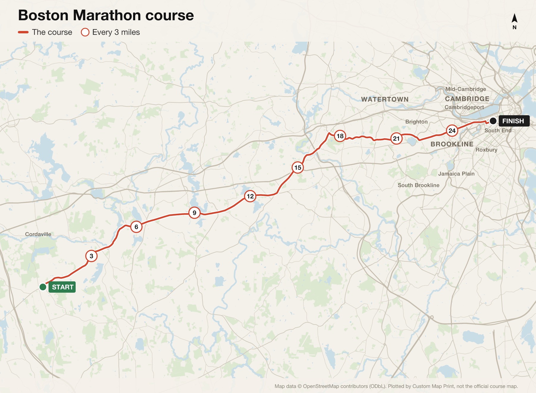
Boston Marathon course at a glance
- Distance
- 26.2 miles (42.195 km)
- Start
- Main Street, Hopkinton
- Finish
- Boylston Street, near the Boston Public Library in Copley Square
- Towns
- Hopkinton, Ashland, Framingham, Natick, Wellesley, Newton, Brookline and Boston
- Elevation
- A drop of about 140 m (460 ft) from start to finish, with the Newton Hills from mile 17.5
- Next race
- Monday 19 April 2027, Patriots' Day
The map is plotted from the published route. Check the organiser's site for this year's exact course.
The Boston Marathon route, mile by mile
- Miles 1 to 4Downhill out of Hopkinton on Route 135 into Ashland. The easiest miles in which to wreck your race: the drop tempts everyone to go fast.
- Miles 5 to 12Route 135 on through Framingham and Natick, gently rolling, then Wellesley and the noise of the Wellesley Scream Tunnel just before halfway.
- Miles 13 to 17Out of Wellesley on Route 16, down into Newton Lower Falls, and a right turn at the fire station onto Commonwealth Avenue.
- Miles 17 to 21The Newton Hills: four climbs along Commonwealth Avenue between miles 17.5 and 21, the last of them Heartbreak Hill, which tops out by Boston College.
- Miles 22 to 25Downhill at last, onto Chestnut Hill Avenue, past Cleveland Circle and along Beacon Street through Brookline to Kenmore Square.
- Mile 26 to the finishRight on Hereford Street, left on Boylston Street, and the finish near the Boston Public Library.
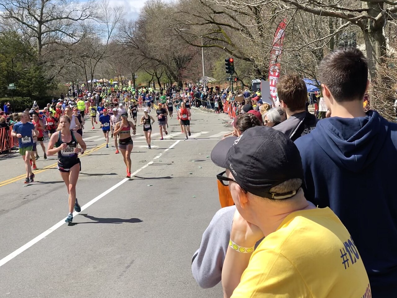
Where it hurts
The first four miles
All downhill, all crowded, and all too easy. Every minute you bank here costs you later.
The Newton Hills
Four climbs from mile 17.5, on legs the downhill has already worked hard.
Heartbreak Hill
The last of the four, around mile 20 by Boston College. Not steep, just badly placed.
The descent after
Beacon Street runs downhill towards the city, and tired quads feel every step of it.
Elevation
Boston drops about 140 m (460 ft) from Hopkinton to Copley Square, most of it early, which is why the Newton Hills hurt: the downhill miles have already worked your quads before the climbing starts. Because it's point to point with a net drop, times here don't count for world records.
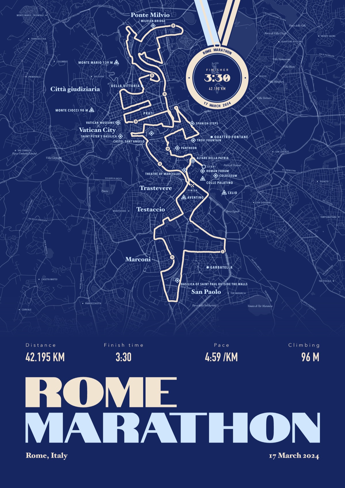
Your Boston Marathon, with your chip time
Your own race drawn street by street from your watch, the landmarks named, and your chip time on a finisher's medal hung from the top of the print.
The print shown is the Rome Marathon. Yours is drawn from your own Boston Marathon file.
£45 unframed Launch price until 31 December
£55 from 1 January · £99 framed
Free delivery to the UK, US, Canada, Australia and New Zealand
Good questions
How long is the Boston Marathon?
26.2 miles, or 42.195 km, point to point from Hopkinton to Boston.
Where does the Boston Marathon start and finish?
It starts on Main Street in Hopkinton and finishes on Boylston Street, near the Boston Public Library in Copley Square.
Where is Heartbreak Hill?
On Commonwealth Avenue in Newton, around mile 20, topping out by Boston College. It's the last of the four Newton Hills.
Is the Boston Marathon downhill?
Overall, yes: it drops about 140 m (460 ft) from start to finish. But the Newton Hills between miles 17.5 and 21 make it anything but easy.
When is the next Boston Marathon?
Monday 19 April 2027, Patriots' Day.
Can I order a print before race day?
Yes. Order now, choose Send later, and send your file after you finish.
Course details from the organiser, checked September 2026. Custom Map Print is not connected to the race or its organisers. The Boston Marathon course from Hopkinton to Boston, miles circled, drawn on OpenStreetMap: © OpenStreetMap contributors, CC BY-SA 2.0, via Wikimedia Commons. Runners crossing Walnut Street in Newton during the 2019 Boston Marathon: ArnoldReinhold, CC BY-SA 4.0, via Wikimedia Commons.


More marathon route maps
- Honolulu Marathon route mapNext race Sunday 13 December 2026
- Marine Corps Marathon route mapNext race Sunday 25 October 2026
- Twin Cities Marathon route mapNext race Sunday 17 October 2027
- Philadelphia Marathon route mapNext race Sunday 22 November 2026
Marathon route maps · Half marathon route maps · Running prints
You ran it, now frame it
Send your file after the race, add your chip time, and we'll take it from there
Make yours