Banff Sunshine trail map
Three mountains on the Continental Divide. Every run and lift on one map, the numbers, and your own days drawn on it.
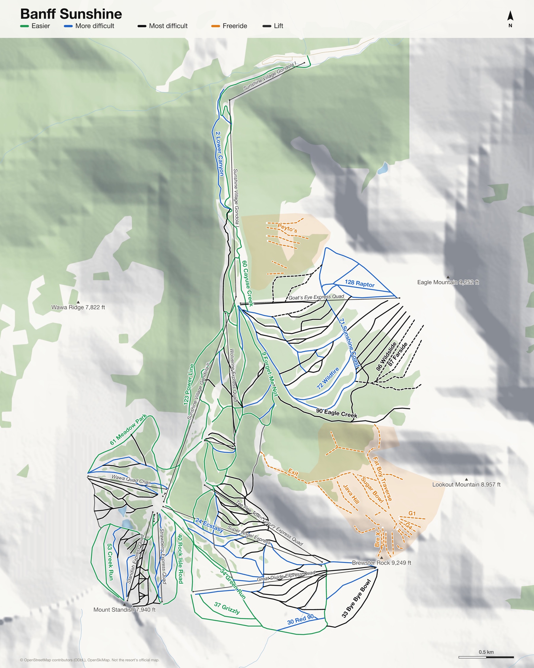
Banff Sunshine at a glance
- Named runs
- 151
- Lifts
- 14
- Runs mapped
- 77 km
- Top of the mapped runs
- 8,829 ft (2,691 m)
- Bottom of the mapped runs
- 5,436 ft (1,657 m)
- Vertical
- 3,392 ft (1,034 m)
From open map and elevation data, September 2026.
Runs and lifts at Banff Sunshine
152 named runs and 11 named lifts, by grade.
Easier (25)
- 4 Juniper
- 9 Forget-Me-Not
- 10 Kid's Play
- 13 Miss Gratz
- 14 Larch Glade
- 15 Cottontail
- 19 Pilgrims
- 20 Packers
- 34 Green Run
- 36 Assiniboine Trail
- 37 Grizzly
- 39 Angel Gully
- 40 Rock Isle Road
- 44 The Dell Valley
- 53 Creek Run
- 60 Cayuse Creek
- 61 Meadow Park
- 64 Slush Cup
- 95 Prune Pickers Pass
- 101 Upper Canyon
- 103 Borderline
- 109 Corral Cut-off
- 122 Springhill
- 123 Power Line
- Banff Avenue
More difficult (30)
- 2 Lower Canyon
- 3 B-Line
- 8 Bluebell
- 12 Short & Sweet
- 21 Barners
- 24 Ecstasy
- 27 World Cup Downhill
- 29 South Divide
- 30 Red 90
- 38 Highway One
- 41 Snowsnake
- 42 Strawberry Face
- 43 Bounty's Bowl
- 54 Little Bunkers
- 59 Wawa Bowl
- 60 Tin Can Alley
- 66 Cherub
- 71 Scapegoat
- 71 Sunshine Coast
- 72 Wildfire
- 74 Stampeders Way
- 75 Sergie's Shortcut
- 98 Christmas Trees
- 99 Roller Coaster
- 113 Strawberry Surprise
- 118 Tilton Trail
- 120 Bunkers
- 128 Raptor
- 130 Eagle
- 137 Chicken
Most difficult (62)
- 5 Goat Chicken Gully
- 6 Wolverine
- 7 Trappers
- 11 Jackrabbit
- 16 The Shoulder
- 17 Bushwackers
- 18 Schoolmarm
- 22 Teepee Main Chutes
- 23 Little Angel
- 25 Big Angel
- 28 Rock Ledges
- 31 Boundry Bowl
- 31 North Divide
- 33 Bye Bye Bowl
- 35 Angel Flight
- 46 Jerry's Run
- 47 Headwall
- 48 Laryx
- 49 Standish Face
- 50 Donkey's Tail
- 51 Virgins
- 52 Big Bunkers
- 55 Paris
- 56 The Waterfall
- 58 Birdcage
- 62 Star Trek
- 63 South 205
- 65 Viking Ridge
- 67 Dirty Little Corner
- 68 Garbage Chutes
- 70 Horto's Revenge
- 73 Rolling Thunder
- 76 The Big Woody
- 78 Afterburner
- 79 Glade Runner
- 82 Cleavage
- 83 Ewe First
- 84 Mother-In-Law
- 85 Goat's Head Soup
- 88 Goatchicken Glade
- 89 Goatsucker Glade
- 90 Eagle Creek
- 92 Fireweed
- 94 Old T-Bar
- 96 Shaken Not Stirred
- 97 Sidewall
- 100 Super Model
- 102 Middle Canyon
- 108 Piste Noir
- 110 North Pocket
- 111 South Pocket
- 112 Tower 30
- 114 Tin Can Trees
- 116 Paris One
- 117 Paris Two
- 119 Standish
- 122 OS Pitch
- 126 Wolverine Liftline
- 127 Teepee Town Liftline
- 133 Sky Dive
- 135 Fall Line
- 136 Sasquatch
Expert (6)
- 80 Freefall
- 81 Hell's Kitchen
- 86 Wildslide
- 87 Farside
- 104 Think Again
- 125 Eagle Glades
Freeride (29)
- Bre X
- Buffalo Jump
- Cream
- Delirium
- Diamond Back
- Engler's
- Exit
- Fat Boy
- Fat Boy Traverse
- G1
- G2
- G3
- G4
- G5
- G6
- Hayes Hill
- Java Hill
- Kain Cliffs
- Luxton's
- Morain Gully
- Peyto's
- Practice Cliffs
- Star $$
- Steel Pipe
- Sugar Bowl
- Sugar Cubes
- Sweet & Low
- Wheeler's
- Z Gully
Lifts (11)
- Goat's Eye Express Quad Chairlift
- Great Divide Express Quad Chairlift
- Jackrabbit Quad Chairlift
- Standish Express Quad Chairlift
- Strawberry Express Quad Chairlift
- Sunshine Village Gondola I Gondola
- Sunshine Village Gondola II Gondola
- Super Angel Express Chairlift
- Tee Pee Town Luxury Express Quad Chairlift
- Wawa Quad Chair Chairlift
- Wolverine Express Quad Chairlift
How Banff Sunshine fits together
Banff Sunshine sits on the Continental Divide, with runs in both Alberta and British Columbia. A gondola climbs from the car park to Sunshine Village, at the centre of three mountains.
Lookout Mountain and Mount Standish hold the open, above-the-trees runs, and Goat's Eye Mountain the steeper ones. Delirium Dive, off Lookout, is the one people talk about.
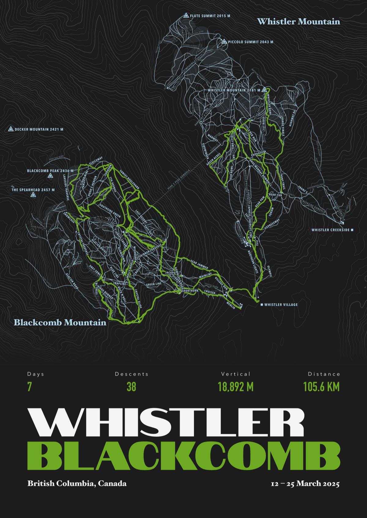
Your Banff Sunshine, run by run
Every run and lift at Banff Sunshine, named, with your own line across it from your phone or watch. One day, one trip or the whole season.
The print shown is Whistler Blackcomb. Yours is drawn from your own days at Banff Sunshine.
£45 unframed Launch price until 31 December
£55 from 1 January · £99 framed
Free delivery to the UK, US, Canada, Australia and New Zealand
For the painted map, see the official Banff Sunshine trail map on the resort's own site.
Good questions
How many runs does Banff Sunshine have?
OpenStreetMap has 151 named runs and 14 lifts at Banff Sunshine. The resort counts its runs its own way, so its number may differ.
How high does Banff Sunshine go?
The highest mapped run starts at about 8,829 ft (2,691 m), and the lowest ends at about 5,436 ft (1,657 m).
Is this the official trail map?
No. Ours is drawn from OpenStreetMap, the open map anyone can edit. For lift status and grooming, use the resort's own map on the day.
Can I get a print of my own days at Banff Sunshine?
Yes. Send the file from Slopes, Strava, a Garmin or any app that exports GPX, and we draw your runs on the whole resort, every run named.
Map data © OpenStreetMap contributors. Custom Map Print is not connected to Banff Sunshine or its operators.
Your runs, on the whole mountain
Send the file from your phone or watch, pick the colours, and we'll take it from there
Make yours