Revelstoke ski map
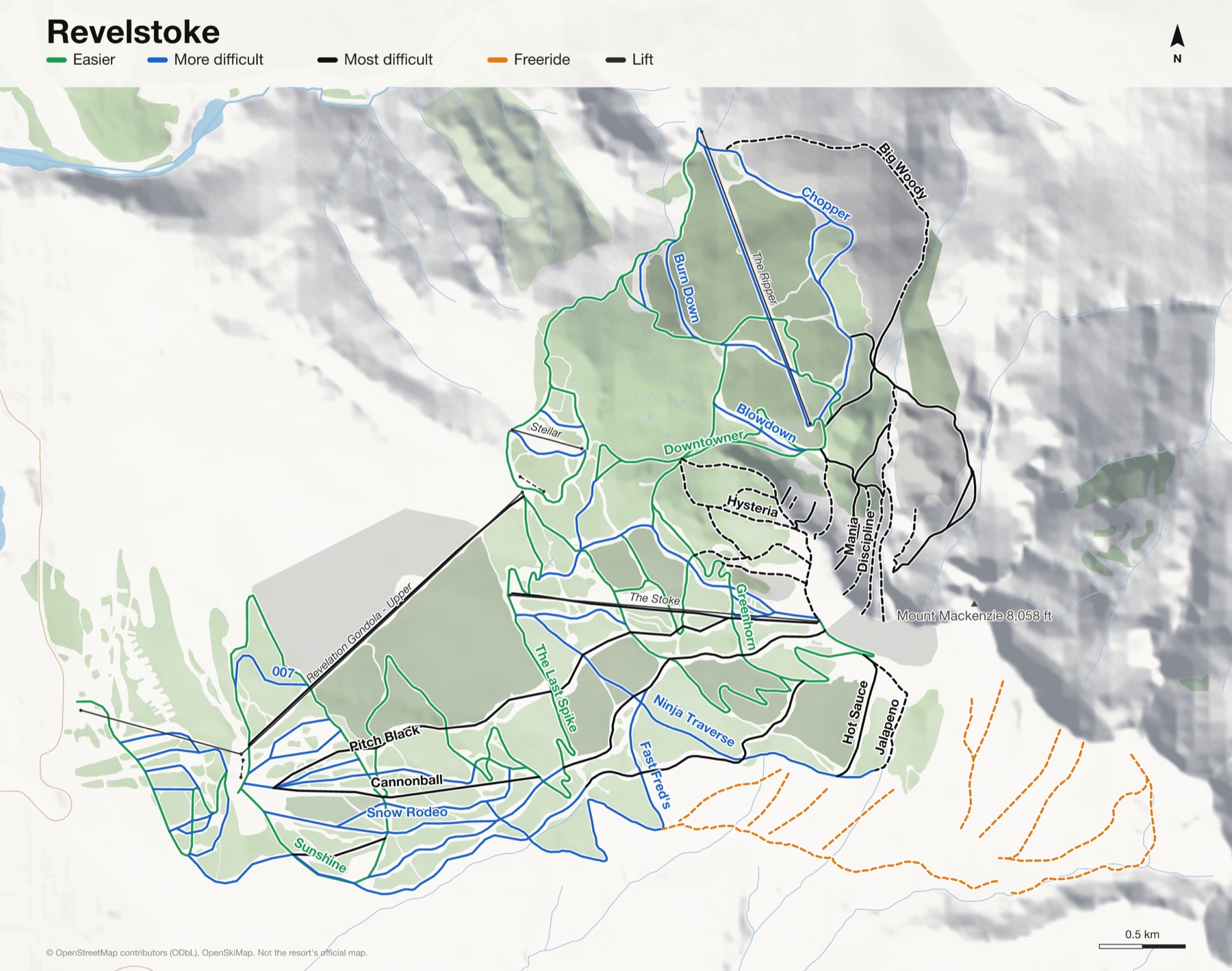
Mount Mackenzie in the Selkirks, straight above the town. Every run and lift on one map, the numbers, and your own days drawn on it.
Revelstoke at a glance
- Named runs
- 73
- Lifts
- 7
- Runs mapped
- 84 km
- Top of the mapped runs
- 7,635 ft (2,327 m)
- Bottom of the mapped runs
- 1,686 ft (514 m)
- Vertical
- 5,948 ft (1,813 m)
From open map and elevation data, September 2026.
Runs and lifts at Revelstoke
64 named runs and 6 named lifts, by grade.
Easier (12)
- Bacon & Eggs
- Big Bend
- Burn Down, Sally Alley
- Downtowner, Sally Alley
- Feller Buncher
- Greenhorn
- Over Easy
- Sally Alley
- Sunshine
- The Last Spike
- The Last Spike (Lower)
- The Ripper Connector
More difficult (25)
- 007
- Blowdown
- Bread & Butter
- Burn Down
- Chopper
- Critical Path
- Denver Dollars
- Downtowner
- Fast Fred's
- Follow Me
- Fowlie's Lap
- Hickory Run
- Hollywood
- Home Run
- Lightning Rod
- Locomotion
- Ninja Traverse
- Practically Pro
- Short Final
- Simmer Down
- Snow Rodeo
- Snow Rodeo (Lower)
- Tickle Trunk
- Tumbelina
- Wooley Bully
Most difficult (20)
- Big Woody
- Cannonball
- Devil's Club
- Drop In
- Greely Bowl
- Greely Trail
- Hot Sauce
- Hysteria
- Jalapeno
- Kill The Banker
- Meet the Neighbours
- Monkey Bars
- Parachute
- Pitch Black
- Pyromania
- Short Shot
- Stay Hungry
- Sweet Spot
- SWF
- Vertigo Ridge
Expert (7)
- Brake Check
- Discipline
- Gracias Ridge
- Mania
- Metal Health
- Powder Assault
- Unlimited Assets
Lifts (6)
- Little Bit Magic carpet
- Revelation Gondola - Lower Gondola
- Revelation Gondola - Upper Gondola
- Stellar Chairlift
- The Ripper Chairlift
- The Stoke Chairlift
How Revelstoke fits together
Revelstoke is Mount Mackenzie in the Selkirk Mountains, rising straight out of the town of Revelstoke. A gondola climbs from the base, and chairs take you on up to the alpine.
It's known for the biggest lift-served vertical in North America and for Last Spike, a run that goes top to bottom. North Bowl and Sub Peak hold the steep terrain.
Your Revelstoke, run by run
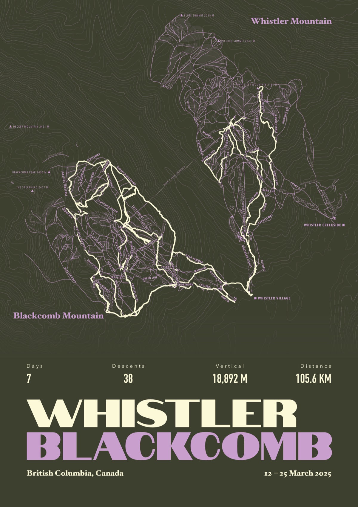
Every run and lift at Revelstoke, named, with your own line across it from your phone or watch. One day, one trip or the whole season.
The print shown is Whistler Blackcomb. Yours is drawn from your own days at Revelstoke.
£45 unframed Launch price until 31 December
£55 from 1 January · £99 framed
Free delivery to the UK, US, Canada, Australia and New Zealand
For the painted map, see the official Revelstoke trail map on the resort's own site.
Good questions
How many runs does Revelstoke have?
OpenStreetMap has 73 named runs and 7 lifts at Revelstoke. The resort counts its runs its own way, so its number may differ.
How high does Revelstoke go?
The highest mapped run starts at about 7,635 ft (2,327 m), and the lowest ends at about 1,686 ft (514 m).
Is this the official trail map?
No. Ours is drawn from OpenStreetMap, the open map anyone can edit. For lift status and grooming, use the resort's own map on the day.
Can I get a print of my own days at Revelstoke?
Yes. Send the file from Slopes, Strava, a Garmin or any app that exports GPX, and we draw your runs on the whole resort, every run named.
Map data © OpenStreetMap contributors. Custom Map Print is not connected to Revelstoke or its operators.
Your runs, on the whole mountain
Send the file from your phone or watch, pick the colours, and we'll take it from there
Make yours