Heavenly trail map
Two states and a view of Lake Tahoe from almost every run. Every run and lift on one map, the numbers, and your own days drawn on it.
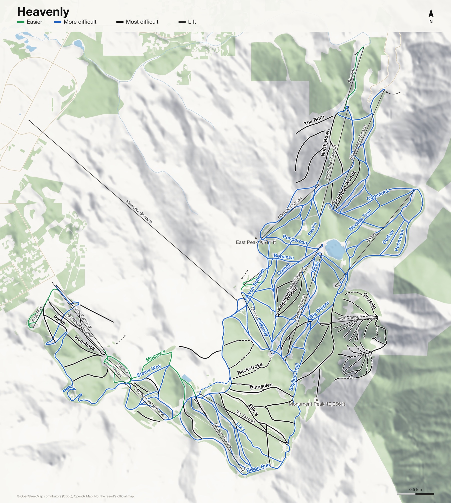
Heavenly at a glance
- Named runs
- 108
- Lifts
- 26
- Runs mapped
- 85 km
- Top of the mapped runs
- 10,013 ft (3,052 m)
- Bottom of the mapped runs
- 6,644 ft (2,025 m)
- Vertical
- 3,369 ft (1,027 m)
From open map and elevation data, September 2026.
Runs and lifts at Heavenly
128 named runs and 23 named lifts, by grade.
Easier (9)
- Boulder Bowl
- Easy Street
- Easy Street, Silver Spur
- Enchanted Forest
- Groove Park
- Maggie's
- Maggie's, Ridge Run
- Patsy's
- Poma Trail
More difficult (55)
- $100 Saddle
- 49'er
- Advanced California Trail
- Aries
- Big Dipper
- Bonanza
- California Trail
- Canyonland
- Cascade
- Cloud 9
- Comet
- Comstock
- Cosmic Wave
- Crossover
- Emily's Run
- Galaxy
- Galaxy Woods
- High Five
- Jack's
- Liz's
- Lower Dipper Return
- Lower Stagecoach
- Meteor
- Mineshaft
- Mombo
- Nevada Trail
- Nova
- Olympic Downhill
- Orion
- Orion's Belt
- Outlaw
- Pepi's
- Perimeter
- Ponderosa
- Powderbowl Run
- Ridge Run
- Round-a-Bout
- Sam's Dream
- Sand Dunes
- Silver Spur
- Skyline Trail
- Stage Line
- Stagecoach
- Stagecoach Return
- Steins Way
- Swing Trail
- Tamarack Return
- The Pines
- Upper Bonanza
- Upper Dipper Return
- Upper Mombo
- Upper North Bowl
- Upper Perimeter
- Von Schmidt
- World Cup
Most difficult (35)
- Advanced Round-a-Bout
- Aries Woods
- Bohemian Grove
- Boulder Chute
- Cepheus
- Dipper Bowl
- Dipper Line
- Dipper Woods
- Double Down
- East Bowl Woods
- Ellie's
- Ellie's Swing
- Express Line
- Fall Line
- Hogsback
- Little Dipper
- Maggie's Canyon
- Milky Way
- Milky Way Bowl
- Mott Canyon Trail
- Nevada Woods
- North Bowl
- Pinnacles
- Pistol
- Powder Line
- Powderbowl Woods
- Ridge Bowl
- Scorpion Woods
- Ski Ways Glades
- Sky Canyon
- Stagecoach Woods
- Tamarack Woods
- The Burn
- Waterfall
- West Bowl
Expert (29)
- Backstroke
- Bill's
- Bobs Boulevard
- Boundry Chutes
- East Bowl
- Ernie's
- Gunbarrel
- Hemlock
- Hully Gully
- Meadows
- North 40
- On Hold
- Outer Limits
- Pac-Man
- Pinenuts
- Pipeline
- Promised Land
- Ramarah's
- Rim Trail
- Snake Eyes
- Southern Comfort
- Stateline
- Sweetwater
- The "Y"
- The Face
- The Fingers
- Under the Gun
- Upper Tamarack Woods
- Widow Maker
Lifts (23)
- Aerial Tramway Cable car
- Big Easy Chairlift
- Boulder Chairlift
- Canyon Express Chairlift
- Comet Express Chairlift
- Dipper Express Chairlift
- First Ride Chairlift
- Galaxy Chairlift
- Groove Chairlift
- Gunbarrel Express Chairlift
- Heavenly Gondola Gondola
- Mott Canyon Chairlift
- North Bowl Express Chairlift
- Olympic Express Chairlift
- Patsy's Chairlift
- Pioneer Rope tow
- Powderbowl Express Chairlift
- Skier Express Funicular
- Sky Express Chairlift
- Stagecoach Express Chairlift
- Tamarack Express Chairlift
- Tubing Hill Magic carpet
- World Cup Chairlift
How Heavenly fits together
Heavenly straddles the California and Nevada state line above South Lake Tahoe, with a gondola climbing straight out of town.
The California side looks out over Lake Tahoe, and the Nevada side over the desert of the Carson Valley. Few resorts have a view like it.
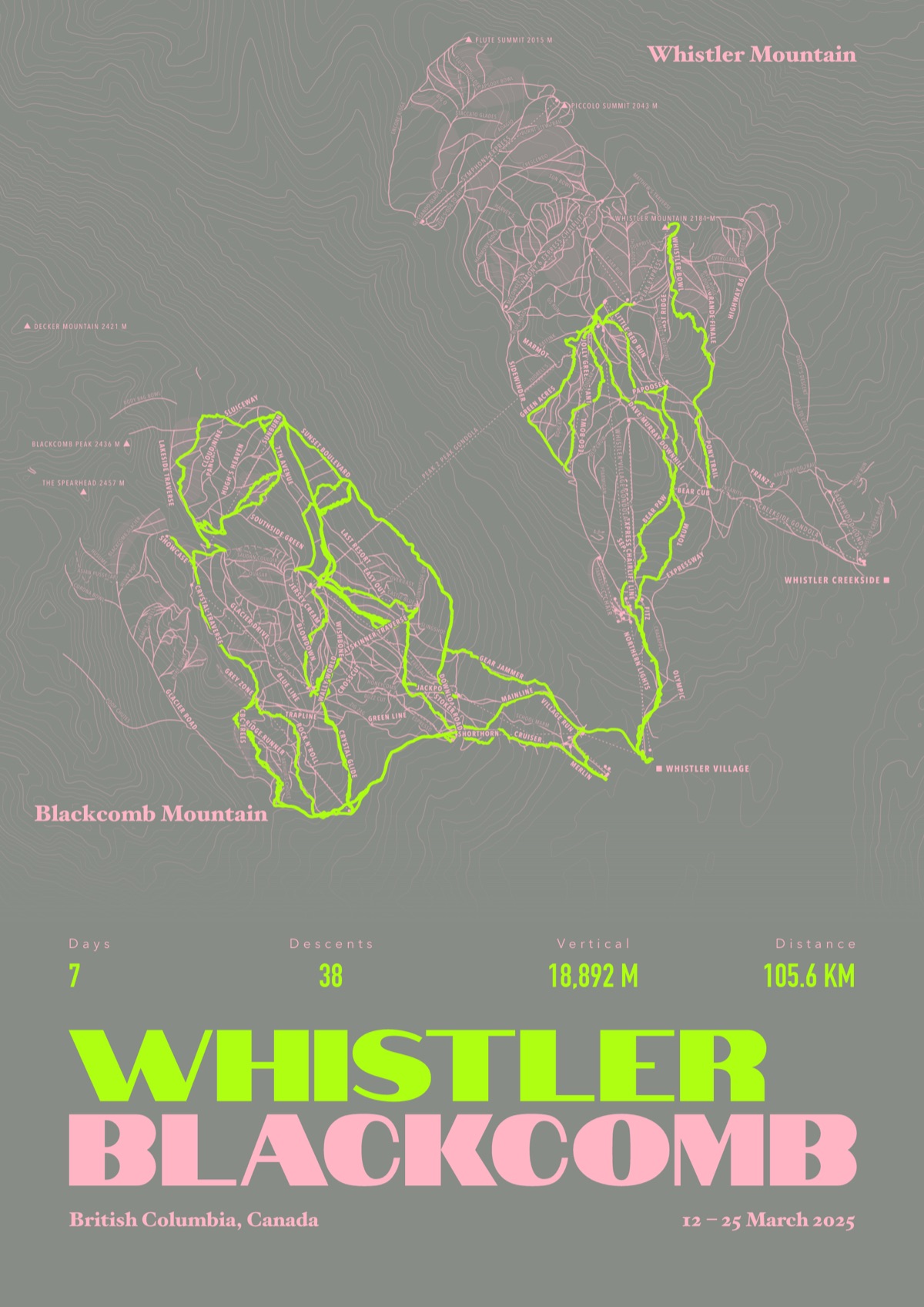
Your Heavenly, run by run
Every run and lift at Heavenly, named, with your own line across it from your phone or watch. One day, one trip or the whole season.
The print shown is Whistler Blackcomb. Yours is drawn from your own days at Heavenly.
£45 unframed Launch price until 31 December
£55 from 1 January · £99 framed
Free delivery to the UK, US, Canada, Australia and New Zealand
For the painted map, see the official Heavenly trail map on the resort's own site.
Good questions
How many runs does Heavenly have?
OpenStreetMap has 108 named runs and 26 lifts at Heavenly. The resort counts its runs its own way, so its number may differ.
How high does Heavenly go?
The highest mapped run starts at about 10,013 ft (3,052 m), and the lowest ends at about 6,644 ft (2,025 m).
Is this the official trail map?
No. Ours is drawn from OpenStreetMap, the open map anyone can edit. For lift status and grooming, use the resort's own map on the day.
Can I get a print of my own days at Heavenly?
Yes. Send the file from Slopes, Strava, a Garmin or any app that exports GPX, and we draw your runs on the whole resort, every run named.
Map data © OpenStreetMap contributors. Custom Map Print is not connected to Heavenly or its operators.
Your runs, on the whole mountain
Send the file from your phone or watch, pick the colours, and we'll take it from there
Make yours