Fernie ski map
Five bowls under the Lizard Range. Every run and lift on one map, the numbers, and your own days drawn on it.
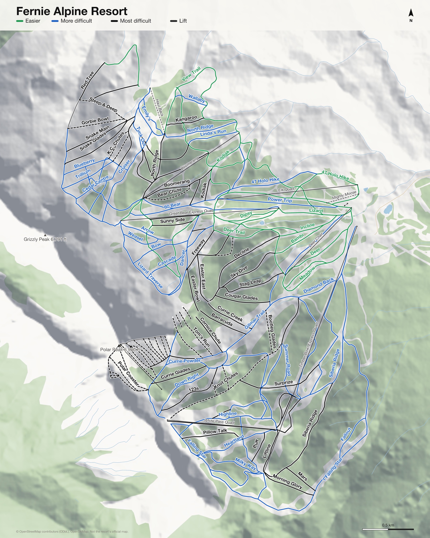
Fernie Alpine Resort at a glance
- Named runs
- 114, counted by hand
- Lifts
- 10
- Runs mapped
- 82 km
- Top of the mapped runs
- 6,880 ft (2,097 m)
- Bottom of the mapped runs
- 3,474 ft (1,059 m)
- Vertical
- 3,406 ft (1,038 m)
From open map and elevation data, September 2026.
Runs and lifts at Fernie Alpine Resort
134 named runs and 10 named lifts, by grade.
Easier (16)
- 47 Holo Hike
- Bambi
- Cedar Trail
- Deer
- Deer Trail
- Dipsy
- Downhill
- Elk
- Giggly Gully
- Holiday
- Incline
- Incline Trail
- Meadow
- Red Tree Road
- Tower 6 Trail
- View Trail
More difficult (44)
- 1 Falling Star
- 60 Bear
- 64 Lower Bear
- 100 %
- Alpine Way
- Arrow
- Bear Connector
- Bear Ridge
- Bear Right
- Blueberry
- Bow
- Cascade
- Cedar Glades
- Cedar High Traverse
- China Might
- Cruiser
- Currie Powder
- Dancer
- Diamond Back
- Down Right
- Emily's
- Falling Star
- Fallout
- Gilmar Trail
- Heartland
- Highline
- Hot Chocolate
- Lizard
- Lizard Traverse
- Milky Way
- North Road
- Power Trip
- Shakey's Acres
- Siberia Ridge
- Silver Fox
- Silver Lining
- Spruce Lee
- Summer Road
- Timber Trail
- Tresspass Trail
- Trillium
- Tuck Out
- Wallaby
- Weasel
Most difficult (43)
- 11 Deep Sea
- 123s
- Alpha Centauri
- Barracuda
- Bear Chute
- Black Cloud
- Boomerang
- Boomerang Ridge
- Buck's Shot
- Cedar Centre
- Cedar Ridge
- China Wall
- Cornice Chute
- Cougar Glades
- Currie Creek
- Currie Glades
- Decline
- Easter Bowl
- Easter East
- Freeway
- Kangaroo
- King Fir
- Kodiak
- Liftline
- Linda's Run
- Mars
- Morning Glory
- North Ridge
- Pillow Talk
- Puff
- Queen Fir
- Quite Right
- Red Tree
- Secret Stash
- Sky Dive
- Snake Glades
- Snake Main
- Stag Leap
- Sun Up
- Sunny Side
- Surprize
- Wally's Follies
- Window Chute #1
Expert (30)
- Anaconda Glades
- Baby Bear
- Barely Legal
- Big Dipper Upper
- Bootleg Glades
- Bozo
- Concussion
- Corner Pocket
- Crusty
- Goldi Locks
- Gorbie Bowl
- Gotta Go
- Grampa Bear
- High Saddle
- K.C. Chutes
- Knot Chutes
- Little Dipper
- Lone Fir
- Mama Bear
- Papa Bear
- Polar Circus
- Polar Coaster
- Polar Lift Line
- Saddle
- Shale Slope
- Side Show Bob's
- Spirit Bear
- Steep & Deep
- Tom's Run
- Window Chute #2
Ungraded (1)
- Snake Ridge
Lifts (10)
- Boomerang Chairlift
- Deer Chair Chairlift
- Elk Quad Chairlift
- Great Bear Express Quad Chairlift
- Haul Back T-bar
- Mighty Moose Button lift
- Mini Moose Magic carpet
- Polar Peak Chair Chairlift
- Timber Bowl Express Quad Chairlift
- White Pass Quad Chairlift
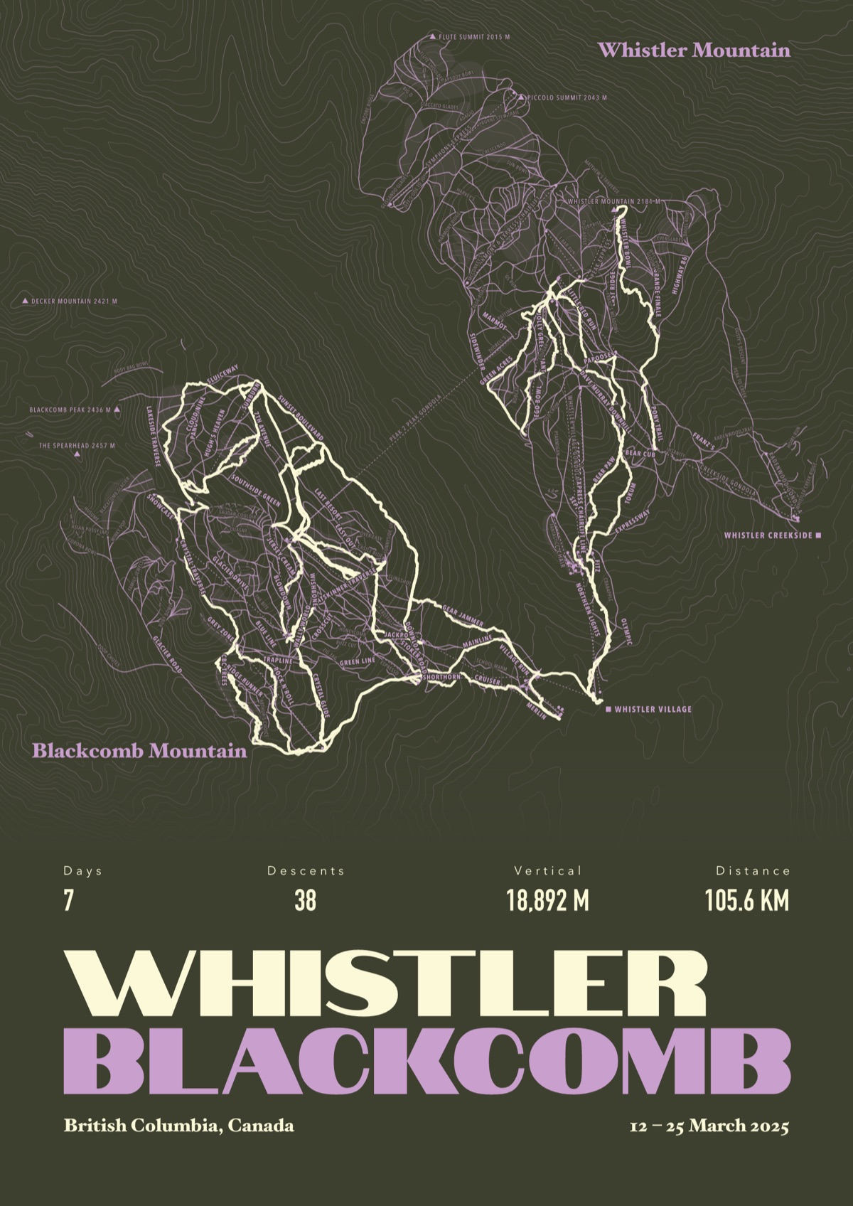
Your Fernie Alpine Resort, run by run
Every run and lift at Fernie Alpine Resort, named, with your own line across it from your phone or watch. One day, one trip or the whole season.
The print shown is Whistler Blackcomb. Yours is drawn from your own days at Fernie Alpine Resort.
£45 unframed Launch price until 31 December
£55 from 1 January · £99 framed
Free delivery to the UK, US, Canada, Australia and New Zealand
For the painted map, see the official Fernie Alpine Resort trail map on the resort's own site.
Good questions
How many runs does Fernie Alpine Resort have?
OpenStreetMap has 114 named runs and 10 lifts at Fernie Alpine Resort. The resort counts its runs its own way, so its number may differ.
How high does Fernie Alpine Resort go?
The highest mapped run starts at about 6,880 ft (2,097 m), and the lowest ends at about 3,474 ft (1,059 m).
Is this the official trail map?
No. Ours is drawn from OpenStreetMap, the open map anyone can edit. For lift status and grooming, use the resort's own map on the day.
Can I get a print of my own days at Fernie Alpine Resort?
Yes. Send the file from Slopes, Strava, a Garmin or any app that exports GPX, and we draw your runs on the whole resort, every run named.
Map data © OpenStreetMap contributors. Custom Map Print is not connected to Fernie Alpine Resort or its operators.
Your runs, on the whole mountain
Send the file from your phone or watch, pick the colours, and we'll take it from there
Make yours