Nakiska ski map
Mount Allan, an hour from Calgary. Every run and lift on one map, the numbers, and your own days drawn on it.
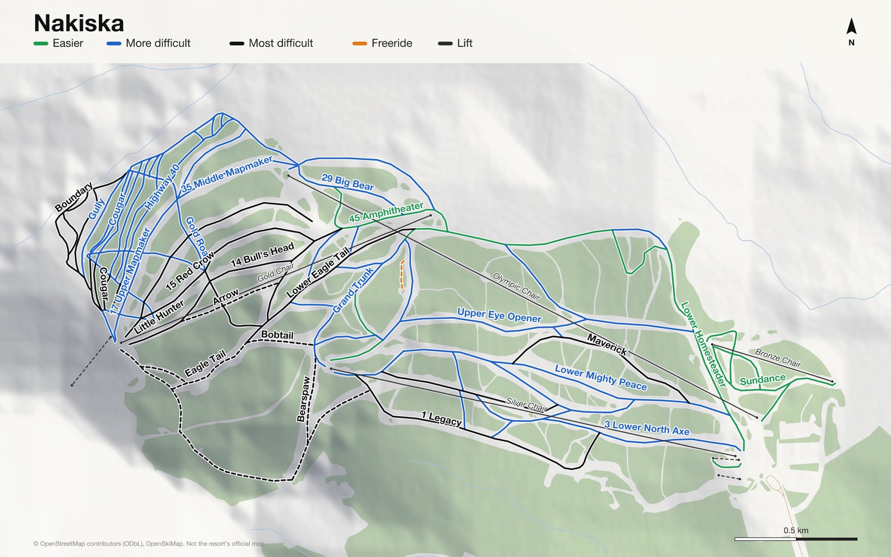
Nakiska at a glance
- Named runs
- 75, counted by hand
- Lifts
- 7
- Runs mapped
- 33 km
- Top of the mapped runs
- 7,434 ft (2,266 m)
- Bottom of the mapped runs
- 4,918 ft (1,499 m)
- Vertical
- 2,513 ft (766 m)
From open map and elevation data, September 2026.
Runs and lifts at Nakiska
72 named runs and 5 named lifts, by grade.
Easier (9)
- 42 Olympic Easy Way
- 45 Amphitheater
- 46 Morley Flats
- 65 Easy Street
- Chinook
- Homesteader Easy Way
- Lower Homesteader
- Powderface
- Sundance
More difficult (37)
- 1a Chiniki Cut-off
- 2a Legacy Connector
- 2b Goodstoney By-Pass
- 3 Lower North Axe
- 11 Whiskey Gap
- 12 Gold Rush
- 17 Upper Mapmaker
- 18 Walking Buffalo
- 19 Upper Homesteader
- 21 Upper Mighty Peace
- 21a Passmore Pass
- 29 Big Bear
- 33 Rue Rado
- 35 Middle Mapmaker
- 41 Ralley Alley
- 44 Lower Mapmaker
- Boundary
- Cutthroat
- Eye Opener Connector
- Goat
- Gold Road
- Grand Trunk
- Grizzly Paw
- Gully
- Homesteader Pitch
- Lower Eye Opener
- Lower Mapmaker
- Lower Mighty Peace
- Magpie
- Marmot
- Old Sun
- Ribbon Creek
- Rustler
- Rye Whiskey
- Switchback
- Upper Eye Opener
- Upper Gully
Most difficult (21)
- 1 Legacy
- 2 North Axe
- 14 Bull's Head
- 15 Red Crow
- 36 Lower Legacy
- Bearspaw
- Cougar
- Crowfoot
- Eagle Tail Connector
- Hallo
- Highway 40
- Little Hunter
- Lower Eagle Tail
- M-9
- Maverick
- North Boundary
- Osprey Alley
- Rye Whisky
- Sparrowhawk
- Upper North Axe
- Whoop-Up
Expert (4)
- Arrow
- Bobtail
- Eagle Tail
- Turbo Traverse
Freeride (1)
- Rabbit Track
Lifts (5)
- Bronze Chair Chairlift
- Gold Chair Chairlift
- Olympic Chair Chairlift
- Platter (Ski Patrol Only) Button lift
- Silver Chair Chairlift
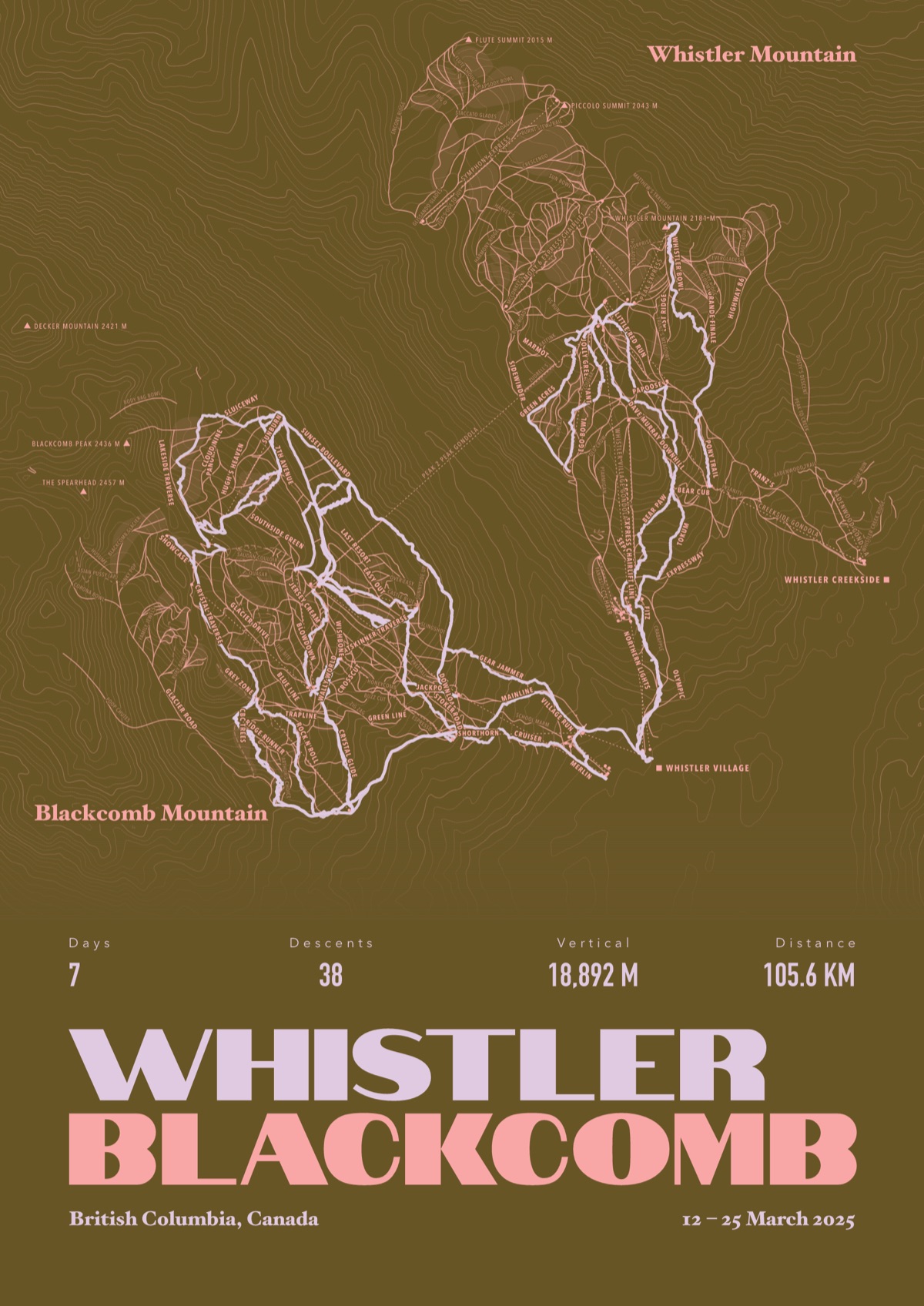
Your Nakiska, run by run
Every run and lift at Nakiska, named, with your own line across it from your phone or watch. One day, one trip or the whole season.
The print shown is Whistler Blackcomb. Yours is drawn from your own days at Nakiska.
£45 unframed Launch price until 31 December
£55 from 1 January · £99 framed
Free delivery to the UK, US, Canada, Australia and New Zealand
For the painted map, see the official Nakiska trail map on the resort's own site.
Good questions
How many runs does Nakiska have?
OpenStreetMap has 75 named runs and 7 lifts at Nakiska. The resort counts its runs its own way, so its number may differ.
How high does Nakiska go?
The highest mapped run starts at about 7,434 ft (2,266 m), and the lowest ends at about 4,918 ft (1,499 m).
Is this the official trail map?
No. Ours is drawn from OpenStreetMap, the open map anyone can edit. For lift status and grooming, use the resort's own map on the day.
Can I get a print of my own days at Nakiska?
Yes. Send the file from Slopes, Strava, a Garmin or any app that exports GPX, and we draw your runs on the whole resort, every run named.
Map data © OpenStreetMap contributors. Custom Map Print is not connected to Nakiska or its operators.
Your runs, on the whole mountain
Send the file from your phone or watch, pick the colours, and we'll take it from there
Make yours