Jackson Hole trail map
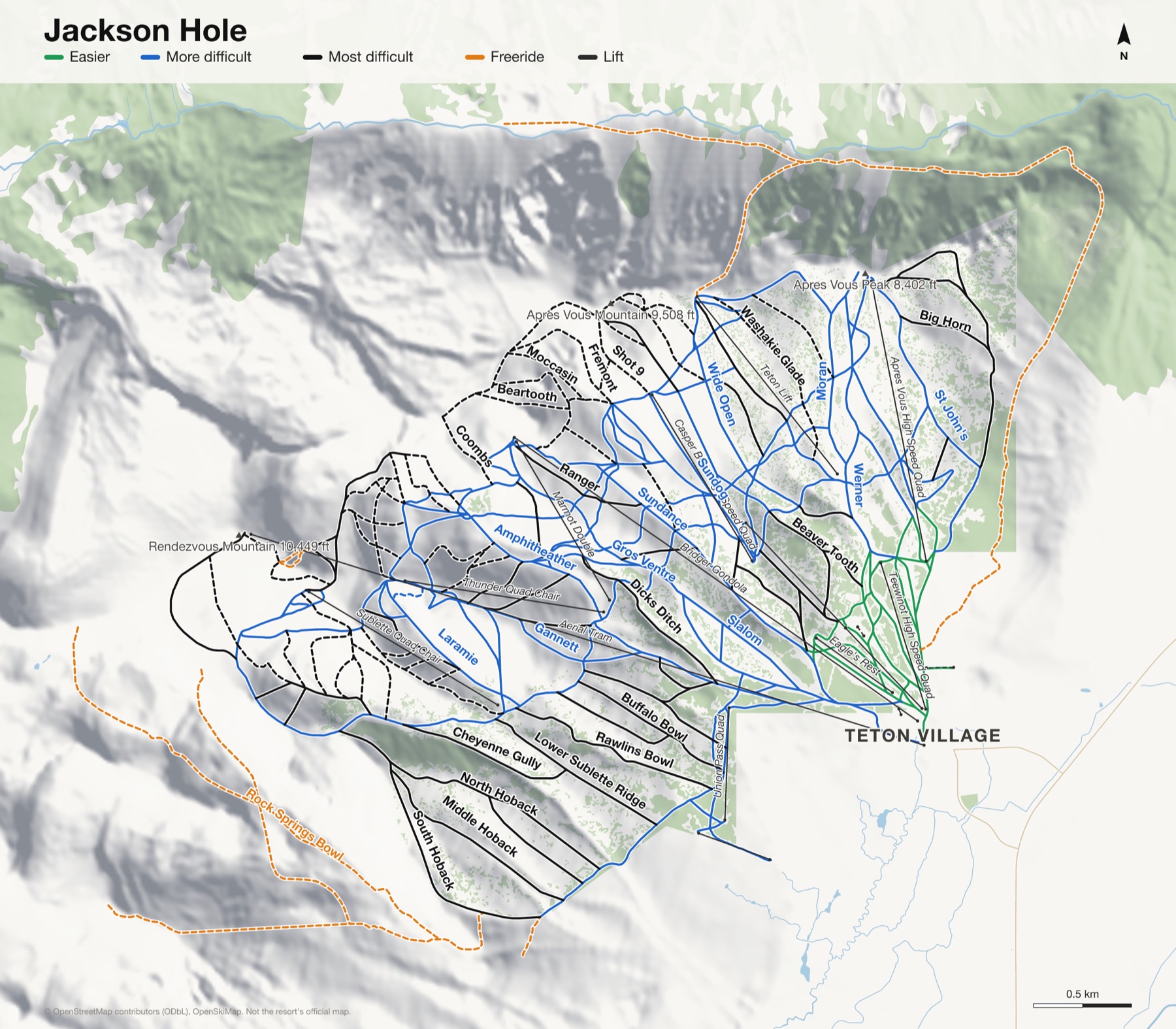
Rendezvous Mountain, the tram and Corbet's Couloir. Every run and lift on one map, the numbers, and your own days drawn on it.
Jackson Hole at a glance
- Named runs
- 111
- Lifts
- 17
- Runs mapped
- 79 km
- Top of the mapped runs
- 10,417 ft (3,175 m)
- Bottom of the mapped runs
- 6,329 ft (1,929 m)
- Vertical
- 4,088 ft (1,246 m)
From open map and elevation data, September 2026.
Runs and lifts at Jackson Hole
138 named runs and 16 named lifts, by grade.
Easier (7)
- Antelope Flats
- Bronco
- Eagle's Rest
- Lower Teewinot
- Lower Werner
- Pooh Bear
- Solitude Way
More difficult (55)
- Amphitheather
- Amphitheather Traverse
- Ashley Ridge
- Blacktail
- Buck Run
- Camp Ground
- Cirque Gully
- Cowboy Couloir
- Crags Run
- Croaky Point
- Eagle's Rest Cutoff
- Easy Does It
- F.I.S. Cut
- Gannett
- Grand
- Grand Traverse
- Gros Ventre
- Hanging Rock
- Hanna
- Horn's Hole Traverse
- Jerry's Way
- Kemmerer (Lower)
- Lander Bowl
- Laramie
- Laramie Bowl
- Laramie Traverse
- Lower Sundance
- Lupine Way
- Moran
- Moran Traverse
- Nez Perce Traverse
- Rendezvous Trail
- Slalom
- Sleeping Indian
- Solitude Traverse, Teton Traverse
- South Pass Traverse
- St John's
- Sundance
- Sundog
- Symmetry
- Teewinot
- Teewinot Gully
- Teton Traverse
- The Stash
- Togwotee Pass Traverse
- Tram Line
- U.P. Connection
- Union Pass Connection
- Union Pass Traverse
- Upper Hanna
- Upper Sundance
- Upper Werner
- Way Home
- Werner
- Wide Open
Most difficult (69)
- Avalanche
- Beartooth
- Beaver Tooth
- Bernie's Bowl
- Big Horn
- Bird In The Hand
- Bivouac
- Broadway
- Buffalo Bowl
- Cascade
- Casper Traverse
- Central Chute
- Cheyenne Bowl
- Cheyenne Gully
- Cirque
- Cirque Bowl
- Coombs
- Crowheart
- Dayton Bowl
- Dicks Ditch
- Dog Face
- Downhill
- Elk Alley
- Expert Chutes
- Flip Point
- Fremont
- Greybull
- Grizzly Glade
- Headwall Traverse
- Hoops Gap
- Jackson Face
- Kemmerer (Upper)
- Liar's Slide
- Limber Pine Chute
- Lower Sublette Ridge
- Middle Hoback
- Moccasin
- Moran Woods
- Nez Perce
- North Colter Ridge
- North Hoback
- Paint Brush
- Pair-A-Chutes
- Pathfinder
- Pepi's Run
- Ranger
- Rawlins Bowl
- Rendezvous Bowl
- Riverton Bowl
- Saratoga Bowl Traverse
- Secret Slope
- Sheridian Bowl
- Shot 7
- Shot 8
- Shot 9
- Snag Tree
- Solitude Gully
- South Colter Ridge
- South Hoback
- Split Rock
- Surprise
- Tensleep
- Tensleep Bowl
- Thunder
- Tower Three Chute
- Two In The Bush (Table Rock)
- Wally World
- Washakie Glade
- Woolsey Woods
Expert (4)
- Alta Chute 1
- Alta Chute 2
- Alta Chute3
- East Ridge Traverse
Freeride (3)
- Corbet's Couloir
- Rock Springs Bowl
- S&S Couloir
Lifts (16)
- Aerial Tram Cable car
- Apres Vous High Speed Quad Chairlift
- Bridger Gondola Gondola
- Casper Bowl High Speed Quad Chairlift
- Eagle's Rest Chairlift
- Kids Ranch Magic Carpet Magic carpet
- Marmot Double Chairlift
- Moose Creek Quad Chairlift
- Solitude Station Magic Carpet Magic carpet
- Sublette Quad Chair Chairlift
- Sweetwater Gondola Lower Gondola
- Sweetwater Gondola Upper Gondola
- Teewinot High Speed Quad Chairlift
- Teton Lift Chairlift
- Thunder Quad Chair Chairlift
- Union Pass Quad Chairlift
How Jackson Hole fits together
Jackson Hole is two mountains above Teton Village: Rendezvous Mountain, with the aerial tram to its summit, and the gentler Après Vous.
It's famous for steep terrain, and for Corbet's Couloir, dropped into from a cornice just below the top of the tram.
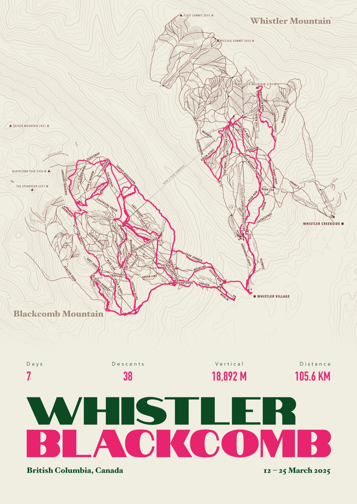
Your Jackson Hole, run by run
Every run and lift at Jackson Hole, named, with your own line across it from your phone or watch. One day, one trip or the whole season.
The print shown is Whistler Blackcomb. Yours is drawn from your own days at Jackson Hole.
£45 unframed Launch price until 31 December
£55 from 1 January · £99 framed
Free delivery to the UK, US, Canada, Australia and New Zealand
For the painted map, see the official Jackson Hole trail map on the resort's own site.
Good questions
How many runs does Jackson Hole have?
OpenStreetMap has 111 named runs and 17 lifts at Jackson Hole. The resort counts its runs its own way, so its number may differ.
How high does Jackson Hole go?
The highest mapped run starts at about 10,417 ft (3,175 m), and the lowest ends at about 6,329 ft (1,929 m).
Is this the official trail map?
No. Ours is drawn from OpenStreetMap, the open map anyone can edit. For lift status and grooming, use the resort's own map on the day.
Can I get a print of my own days at Jackson Hole?
Yes. Send the file from Slopes, Strava, a Garmin or any app that exports GPX, and we draw your runs on the whole resort, every run named.
Map data © OpenStreetMap contributors. Custom Map Print is not connected to Jackson Hole or its operators.
Your runs, on the whole mountain
Send the file from your phone or watch, pick the colours, and we'll take it from there
Make yours