Telluride trail map
A box canyon in the San Juans, and a gondola over the ridge. Every run and lift on one map, the numbers, and your own days drawn on it.
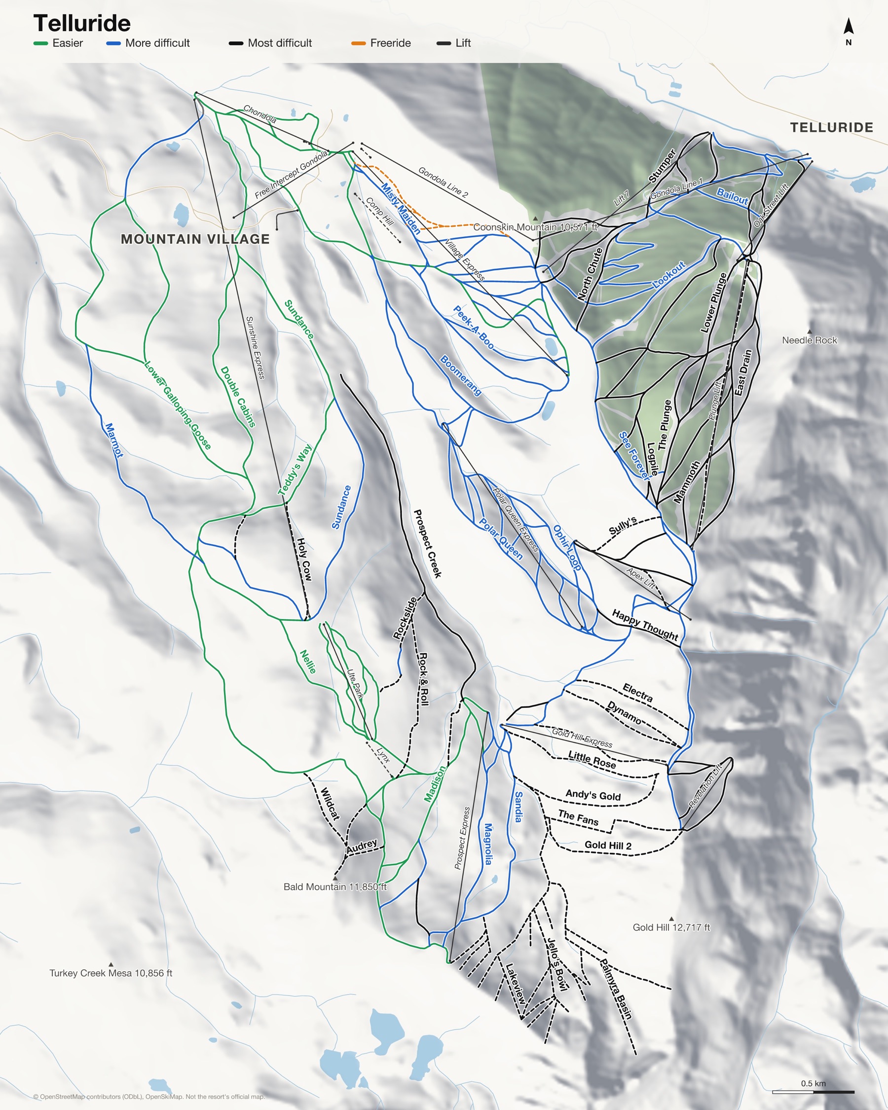
Telluride at a glance
- Named runs
- 157
- Lifts
- 20
- Runs mapped
- 100 km
- Top of the mapped runs
- 12,536 ft (3,821 m)
- Bottom of the mapped runs
- 8,730 ft (2,661 m)
- Vertical
- 3,802 ft (1,159 m)
From open map and elevation data, September 2026.
Runs and lifts at Telluride
127 named runs and 19 named lifts, by grade.
Easier (17)
- Bridges
- Double Cabins
- Galloping Goose
- Little Maude
- Lower Boomerang
- Lower Village Bypass
- Madison
- May Girl
- Meadows
- Nellie
- Sundance
- Teddy's Way
- The Peaks
- Ute Park
- Village Bypass
- Village Bypass, Misty Maiden
- Village Bypass, Pick'N Gad
More difficult (38)
- Alta
- Boomerang
- Butterfly
- Cake Walk
- Dew Drop
- Easy Out
- Enchanted Forest
- Galloping Goose Ski Run
- Gold Rush
- Guide Pro Cake Walk
- Guide Pro Lynx Loop, Rockslide
- Henry's North
- Henry's South
- Hermit
- Humbolt Draw
- Kid's Hill
- Last Chance
- Lookout
- Lower Happy Thought
- Lower Woozley's Way
- Magnolia
- Magnolia Headwall
- Marmot
- Misty Maiden
- Ophir Loop
- Peek-A-Boo
- Pick'N Gad
- Polar Queen
- Sandia
- See Forever
- Sheridan Headwall
- Silvertip
- Smuggler
- Stella
- Telluride Trail
- Woozley's Way
- Woozley's Way, See Forever
- Wozzley's Way
Most difficult (27)
- Apex
- Bailout
- Bee's Run
- Bushwacker
- Captain Jack's
- Cimarron
- Confidence
- Jaws
- Joint Point
- Liberty Bell
- Logpile
- Lower Plunge
- Majestic
- Mammoth
- Milk Run
- O'Reilly's
- Palmyra Basin
- Pandora
- Prospect Creek
- Prospect Woods
- Satisfaction
- Silvercloud
- Spiral Stairs
- Stumper
- Sweet Martha
- The Fans
- The Plunge
Expert (43)
- Allais Alley
- Andy's Gold
- Audrey
- Cats Paw
- Crystal
- Dihedral Chute
- Dihedral Face
- Dynamo
- East Drain
- Easy Chute
- Electra
- Genevieve
- Gold Hill 1
- Gold Hill 2
- Gold Hill 6
- Happy Thought
- Holy Cow
- Jackpot
- Jello's Bowl
- Kant-Mak-M
- La Rosa
- Lakeview
- Little Rose
- Millions
- Mine Shaft
- Mountain Quail
- Nice Chute
- North Chute
- Pee-Wee's Big Adventure
- Power Line
- Review
- Rock & Roll
- Rockslide
- Runaway Train
- Snowslide Cabin
- Sully's
- The Roll
- Way Easy
- West Drain
- Westlake
- Wildcat
- Zipper Rock
- Zulu Queen
Freeride (1)
- Hoot Brown Terrain Park
Ungraded (1)
- Lower Galloping Goose
Lifts (19)
- Apex Lift Chairlift
- Chondola Chairlift and gondola
- Comp Hill Button lift
- Free Intercept Gondola Gondola
- Gold Hill Express Chairlift
- Gondola Line 1 Gondola
- Gondola Line 2 Gondola
- Gondola Magic Carpet Magic carpet
- Lift 7 Chairlift
- Lynx Button lift
- Meadows Magic Carpet Magic carpet
- Oak Street Lift Chairlift
- Plunge Lift Chairlift
- Polar Queen Express Chairlift
- Prospect Express Chairlift
- Revelation Lift Chairlift
- Sunshine Express Chairlift
- Ute Park Chairlift
- Village Express Chairlift
How Telluride fits together
Telluride sits in the San Juan Mountains, with the old town in a box canyon on one side of the ridge and Mountain Village on the other. A free gondola runs between them, over the top.
The runs above town are steep, and the hike-to terrain on the high ridges is some of the most serious in Colorado.
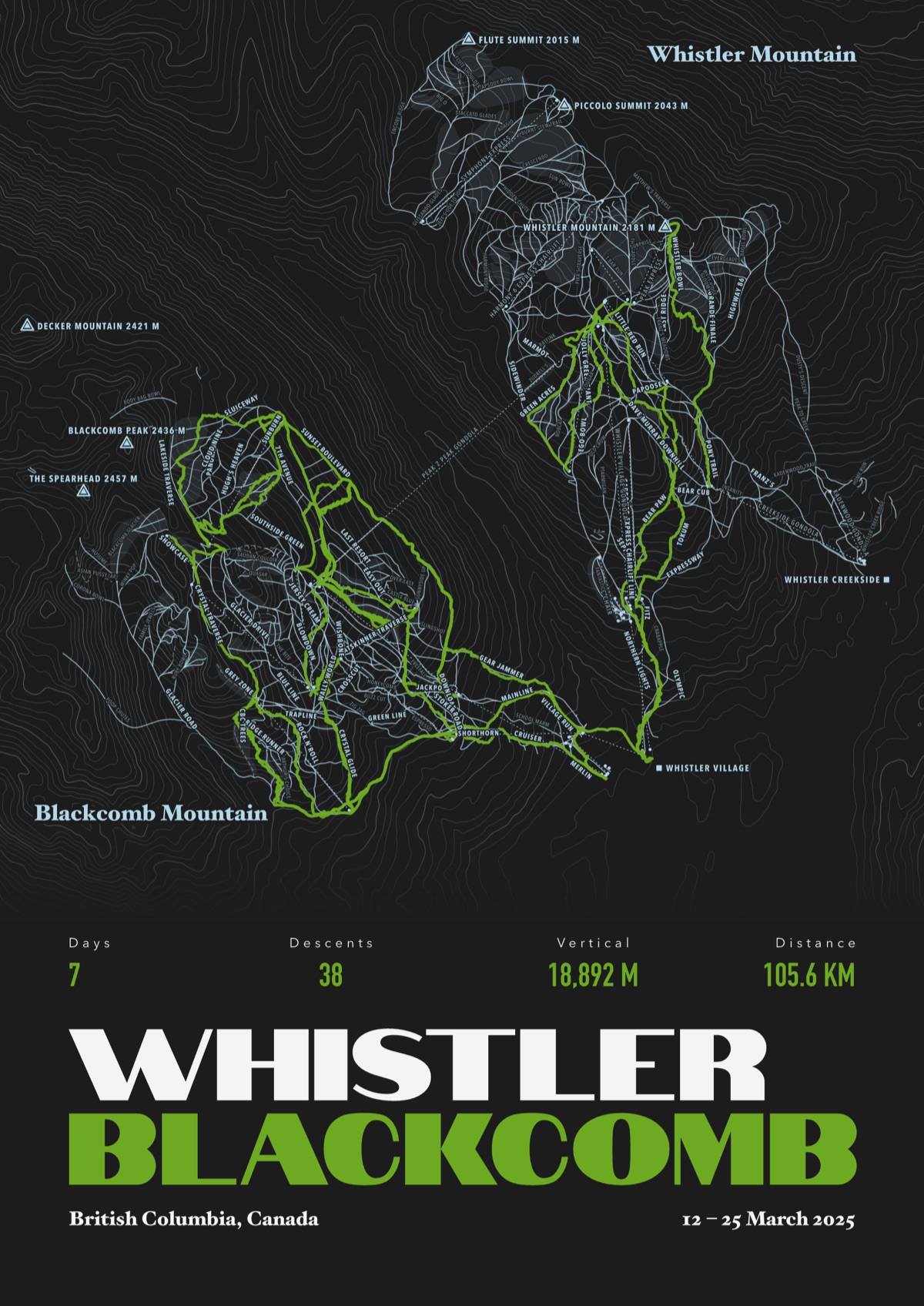
Your Telluride, run by run
Every run and lift at Telluride, named, with your own line across it from your phone or watch. One day, one trip or the whole season.
The print shown is Whistler Blackcomb. Yours is drawn from your own days at Telluride.
£45 unframed Launch price until 31 December
£55 from 1 January · £99 framed
Free delivery to the UK, US, Canada, Australia and New Zealand
For the painted map, see the official Telluride trail map on the resort's own site.
Good questions
How many runs does Telluride have?
OpenStreetMap has 157 named runs and 20 lifts at Telluride. The resort counts its runs its own way, so its number may differ.
How high does Telluride go?
The highest mapped run starts at about 12,536 ft (3,821 m), and the lowest ends at about 8,730 ft (2,661 m).
Is this the official trail map?
No. Ours is drawn from OpenStreetMap, the open map anyone can edit. For lift status and grooming, use the resort's own map on the day.
Can I get a print of my own days at Telluride?
Yes. Send the file from Slopes, Strava, a Garmin or any app that exports GPX, and we draw your runs on the whole resort, every run named.
Map data © OpenStreetMap contributors. Custom Map Print is not connected to Telluride or its operators.
More ski resort maps
- Jackson Hole trail mapWyoming, USA · 111 named runs · 17 lifts
- Mammoth trail mapCalifornia, USA · 120 named runs · 28 lifts
- Fernie ski mapBritish Columbia, Canada · 114 named runs · 10 lifts
- Nakiska ski mapAlberta, Canada · 75 named runs · 7 lifts
Colorado ski resorts map · All ski resort maps · Ski prints · Snowboard prints
Your runs, on the whole mountain
Send the file from your phone or watch, pick the colours, and we'll take it from there
Make yours