Stowe trail map
Mount Mansfield and Spruce Peak. Every run and lift on one map, the numbers, and your own days drawn on it.
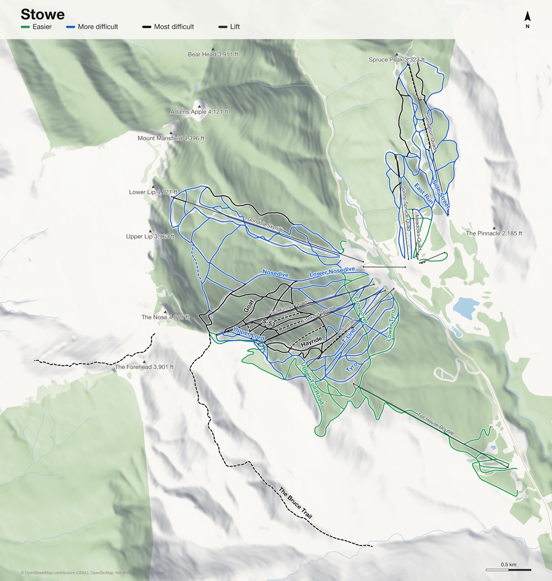
Stowe at a glance
- Named runs
- 134
- Lifts
- 12
- Runs mapped
- 67 km
- Top of the mapped runs
- 3,648 ft (1,112 m)
- Bottom of the mapped runs
- 1,257 ft (383 m)
- Vertical
- 2,392 ft (729 m)
From open map and elevation data, September 2026.
Runs and lifts at Stowe
126 named runs and 12 named lifts, by grade.
Easier (21)
- Birch Glades
- Catwalk
- Chapel Lane
- Crossover
- Easy Mile
- Easy Street
- Home Run
- Inspiration
- Jake's Ride
- Lower Lord
- Lower National
- Lower Toll Road
- Lower Tyro
- Meadows
- Mountain Glen
- Ryan's Folly
- Stowe Derby Trail
- Sunrise Glades
- Tollhouse
- Townhouse
- Upper Toll Road
More difficult (71)
- #1 Cut Across
- #2 Cut Across
- Armando's Alley
- Base Camp Road
- Chin Clip Runout
- Christiana
- Christie Glades
- Cliff Trail
- Competition Hill
- Dalton
- Duck Walk
- East Run
- Glades Return
- Gondolier
- Gulch
- Hayride
- Hayride Loop
- High Road
- Houghton's
- Jug Handle
- Last Exit
- Lookout Loop
- Lord
- Lord Loop
- Lower Cliff Trail
- Lower Gondolier
- Lower Gulch
- Lower Hayride
- Lower Liftline
- Lower Lookout
- Lower Main Street
- Lower North Slope
- Lower Nosedive
- Lower Perry Merrill
- Lower Ridgeview
- Lower Rimrock
- Lower Smugglers
- Lower Standard
- Lower Starr
- Lower Sterling
- Lower Switchback
- Lower T-Line
- Lower West Run
- Main Street
- Main Street Headwall
- Meadows East Glades
- Midway
- North Slope
- Nosedive
- Perry Merrill
- Ridge Run
- Ridgeview
- Rimrock
- Sepp's Run
- Side Street
- Slalom Hill
- Standard
- Sterling
- Sunrise
- Switchback
- T-Line
- Tyro
- Upper Gondolier
- Upper Lord
- Upper Main Street
- Upper Meadows
- Upper Perry Merrill
- Upper Sterling
- Upper T-Line
- West Run
- West Slope
Most difficult (13)
- Centerline
- Chin Clip
- Freddie's Chute
- Maiden Lane
- Phil's Zuggy
- S-53
- Shftr's Shot
- Upper Hayride
- Upper Nosedive
- Upper Smugglers
- Waterfall
- West Smugglers
- Whirlaway
Expert (21)
- Bypass
- Goat
- Hackett's Highway
- Haychute
- Liftline
- Lookout
- Lookout Glades
- Lower Goat
- National
- National Drop-In
- S-53 Glades
- Spruce Line
- Starr
- The Bruce Trail
- The Teardrop Trail, Tear Drop Trail
- Tres Amigos Glades
- Upper Goat
- Upper Liftline
- Upper Lookout
- Upper National
- Upper Starr
Lifts (12)
- Adventure Carpet Magic carpet
- Adventure Triple Chairlift
- FourRunner Quad Chairlift
- Gondola Skyride Gondola
- Lookout Double Chairlift
- Meadows Carpet Magic carpet
- Meadows Quad Chairlift
- Over Easy Transfer Gondola Gondola
- Sensation Quad Chairlift
- Sunny Spruce Quad Chairlift
- Sunrise Chairlift
- Toll House Double Chairlift
How Stowe fits together
Stowe is two mountains: Mount Mansfield, the highest in Vermont, and Spruce Peak across the road, linked by a gondola.
Mansfield holds the Front Four, the steep, narrow runs Stowe is known for: National, Liftline, Goat and Starr.
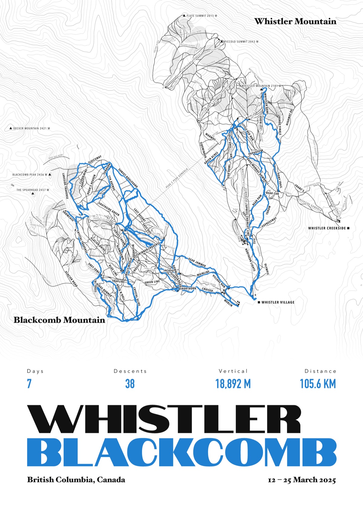
Your Stowe, run by run
Every run and lift at Stowe, named, with your own line across it from your phone or watch. One day, one trip or the whole season.
The print shown is Whistler Blackcomb. Yours is drawn from your own days at Stowe.
£45 unframed Launch price until 31 December
£55 from 1 January · £99 framed
Free delivery to the UK, US, Canada, Australia and New Zealand
For the painted map, see the official Stowe trail map on the resort's own site.
Good questions
How many runs does Stowe have?
OpenStreetMap has 134 named runs and 12 lifts at Stowe. The resort counts its runs its own way, so its number may differ.
How high does Stowe go?
The highest mapped run starts at about 3,648 ft (1,112 m), and the lowest ends at about 1,257 ft (383 m).
Is this the official trail map?
No. Ours is drawn from OpenStreetMap, the open map anyone can edit. For lift status and grooming, use the resort's own map on the day.
Can I get a print of my own days at Stowe?
Yes. Send the file from Slopes, Strava, a Garmin or any app that exports GPX, and we draw your runs on the whole resort, every run named.
Map data © OpenStreetMap contributors. Custom Map Print is not connected to Stowe or its operators.
Your runs, on the whole mountain
Send the file from your phone or watch, pick the colours, and we'll take it from there
Make yours